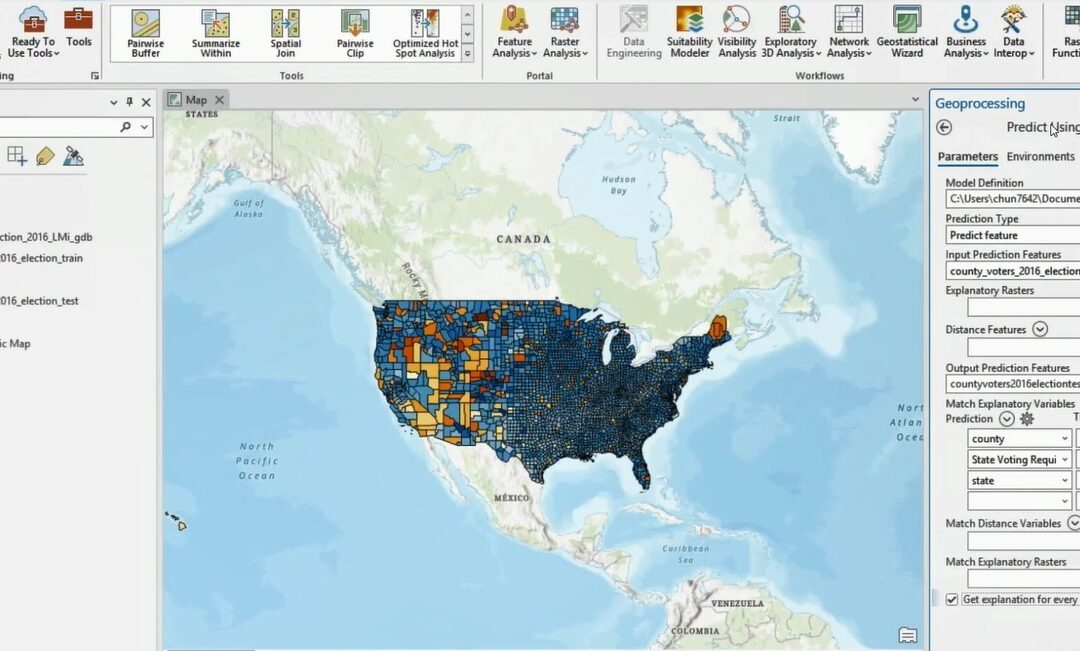
Artificial Intelligence (AI) Capabilities in ArcGIS Pro
ArcGIS Pro offers a set of AI-enabled tools GIS workflows that are meant to simplify workflows and offer advanced capabilities. We’ll look at some of the AI tools that come with ArcGIS Pro and explain how they differ from each other. Artificial Intelligence (AI)...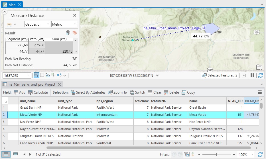
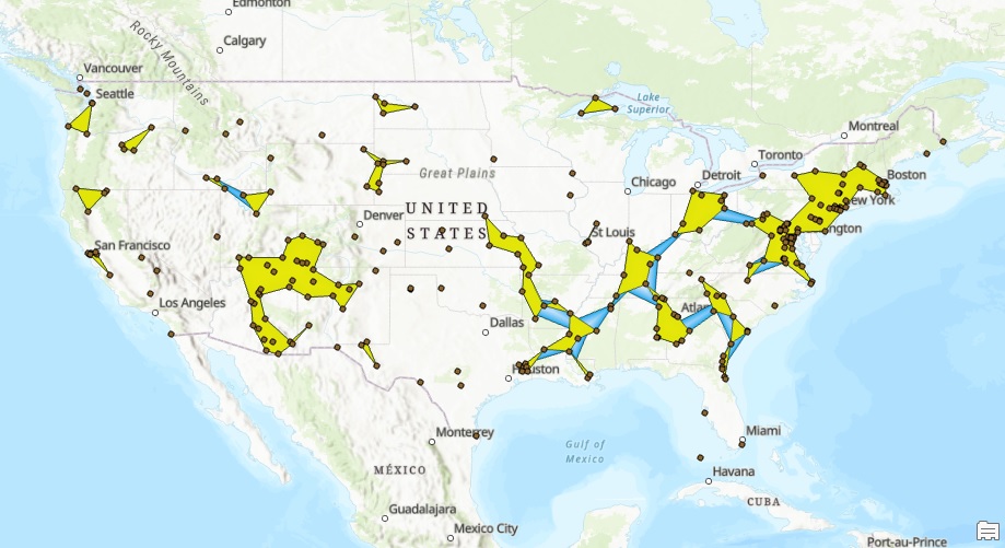
How to Calculate Distances Between Features in ArcGIS Pro
The Near geoprocessing tool in ArcGIS Pro calculates distances between features in different layers. We’ll demonstrate how this tool works using a point and polygon layer. To calculate the distance between two features you could use the measure tool that is available...
Convert a Raster or Vector Layer to KML in ArcGIS Pro
This tutorial covers a recently enhanced conversion tool in ArcGIS Pro to convert a raster or vector layer to KML in ArcGIS Pro. In ArcGIS Pro 3.x, the Layer to KML tool is enhanced to allow you to convert feature layers to basic KML files. We’ll describe how that...