Tutorial: Using Pro’s Buffer Tools Inside Polygons and Polylines
In this tutorial, we’ll show how to use negative buffer values to accentuate the edges of a polygon. Next, we’ll show how you can create a buffer on one side of a polyline, for example to calculate the distance from a coastline land inward. ArcGIS Pro offers multiple...
Tutorial: Using Python to Find Identical Features in a GIS Dataset
In this tutorial you’ll learn how to identify duplicate entries in a GIS dataset using ArcGIS Pro Python Notebooks. If you want to use Python to find duplicate entries in a feature dataset, there are several ways to do so. This tutorial features two...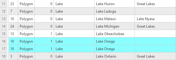
Tutorial: Finding Identical Features in a Dataset with ArcGIS Pro
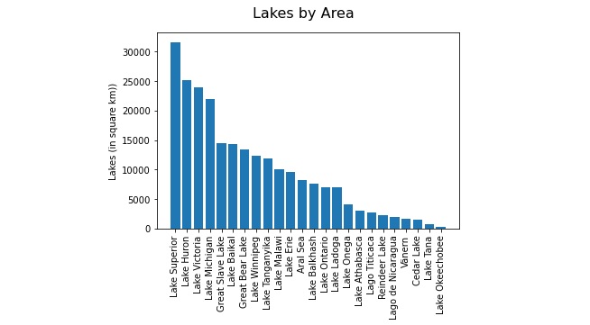
In this tutorial, we’ll explain how you can find identical features (also known as duplicate data) in a feature dataset. Step 1: Download the data We will use the Natural Earth quick start kit. In the tutorial covering bar charts using the matplotlib Python...