Some things to know about Business Analyst Widget in Experience Builder
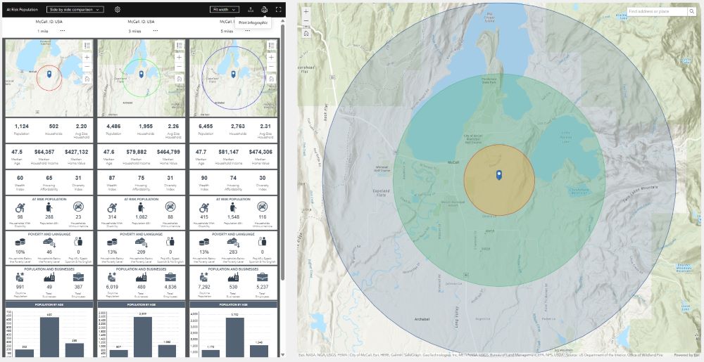
The Business Analyst widget helps us visualize key indicators and data about locations using interactive infographics. These ready-to-use infographics can be used in ArcGIS Business Analyst Web App or ArcGIS Community Analyst with additional licensing, or you can...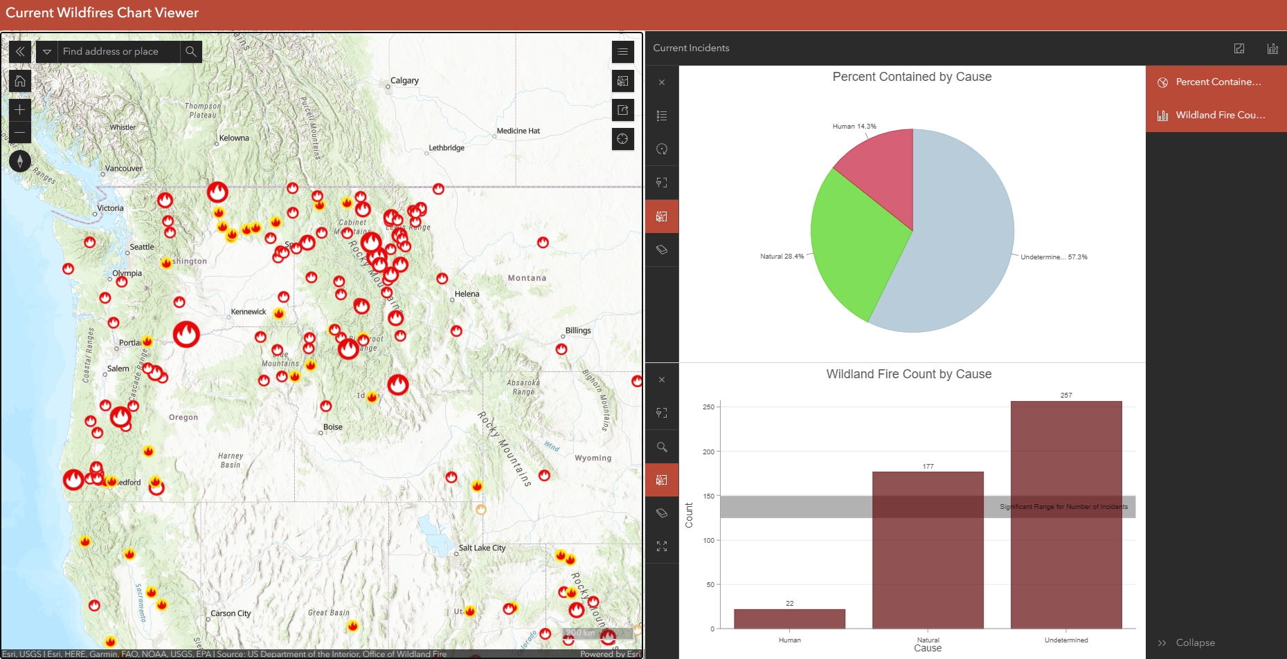
Configure Charts in Map Viewer and Use them in the Chart Viewer Instant App
There are now 19 Instant Apps to choose from in ArcGIS Online, two of which are still in Beta testing. What is an Instant App? Instant Apps are the newest no-code, configurable web applications offered in ArcGIS Online. They have been created to meet the requirements...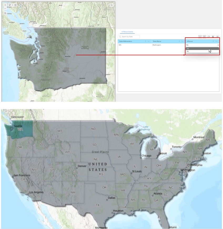
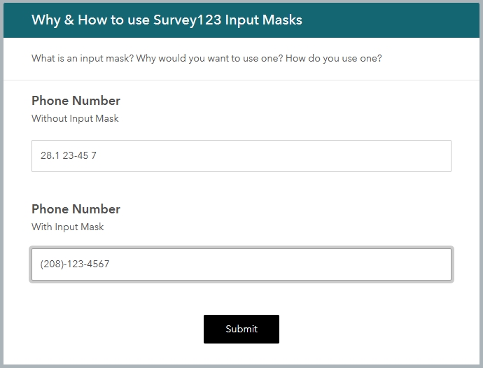
Allow Users to Edit Data Directly in a Table in Experience Builder
ArcGIS Online’s Experience Builder provides great flexibility for data-editing mechanisms. The edit widget is progressing in its editing capabilities and is important if your users need to create new features. However, many users only need to modify or update...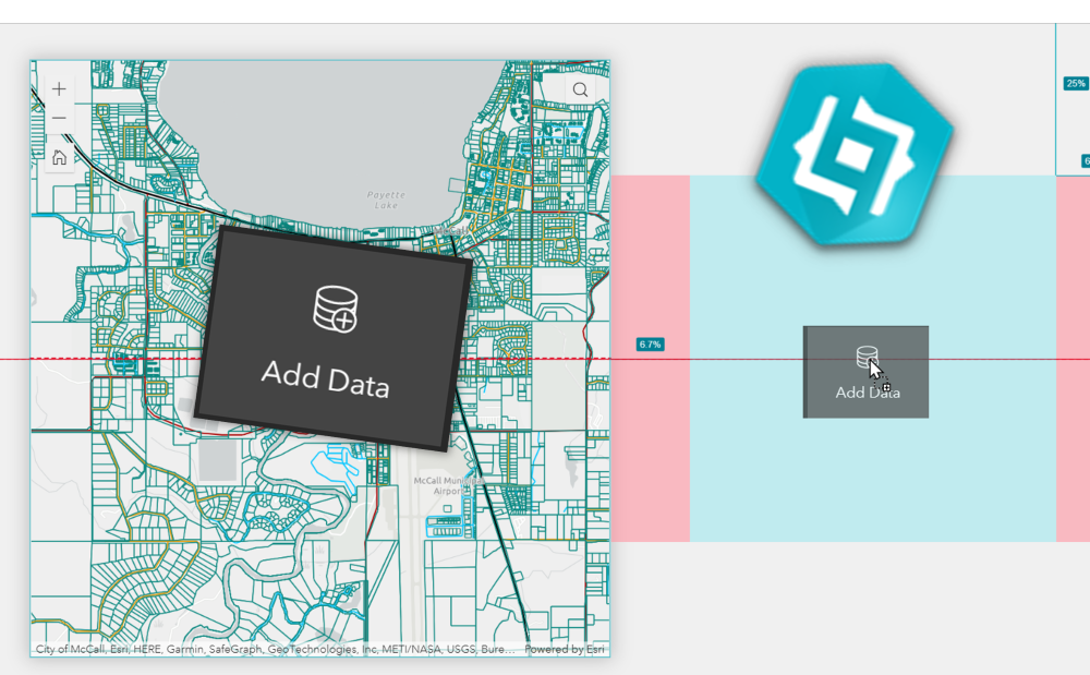
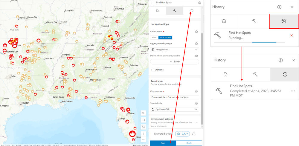
Allow your Users to Add Data to Maps using the Add Data Widget in Experience Builder
We’ve been asking for the Add Data widget since the debut of Experience Builder, and as of the Q1 2023 update our wishes have been granted. We at Geospatial Training Services are also counting down the days until the Q2 2023 update which will include a few more...