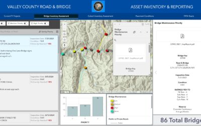
The following is a sneak peek at the first part of a sample chapter from our newest book: Programming ArcGIS Pro with Python: 3rd Edition. This book has been updated for ArcGIS Pro 3.x, and will teach you how to automate your ArcGIS Pro 3.x geoprocessing tasks using...
Articles & Tutorials
Simple and Effective Settings to Streamline Editing in ArcGIS Pro
Editing is much easier in ArcGIS Pro than it was in ArcMap. Now that I am accustomed to ArcGIS Pro's streamlined editing workflow, going back into ArcMap to edit something feels clunky and outdated. In this short article, I will highlight a few simple editing settings...
Allow Users to Edit Data Directly in a Table in Experience Builder
ArcGIS Online's Experience Builder provides great flexibility for data-editing mechanisms. The edit widget is progressing in its editing capabilities and is important if your users need to create new features. However, many users only need to modify or update...
Data Accuracy: Why and How to create choice lists in ArcGIS Pro and ArcGIS Online
HOW TO ENSURE DATA QUALITY High-quality data allows organizations to make better business decisions. One of the foundations of being a GIS Professional is data creation and management. We learn early in our education and careers that data management is one of the...
Understanding ArcGIS Pro Layer and Map Files
One of the more difficult aspects of getting up to speed with GIS software is the wide variety of data formats that can be used. Just to name a few we have two or three types of geodatabase including file and enterprise for ArcGIS Pro and a third, personal...
Allow your Users to Add Data to Maps using the Add Data Widget in Experience Builder
We've been asking for the Add Data widget since the debut of Experience Builder, and as of the Q1 2023 update our wishes have been granted. We at Geospatial Training Services are also counting down the days until the Q2 2023 update which will include a few more useful...
New Analysis Capabilities in ArcGIS Online Map Viewer (Find Hot Spots)
It has been rare that I have had to venture back into Map Viewer Classic from the new Map Viewer. For one thing, I haven't wanted to because of the awesome functions and cartographic features available in the new Map Viewer. The most consistent reason for my going...
How to Survive the Deprecation of Classic StoryMaps & Web AppBuilder
Classic StoryMaps have been in extended support since September of 2021. Because extended support will end in October of 2023, ESRI has been urging customers to transition their applications as soon as possible. What does this mean? When Extended Support ends, Mature...
How to configure the Query Widget with a Spatial Buffer in Experience Builder
With every iteration of Experience Builder comes extended functionality and new and improved ways of configuring your application widgets. Experience Builder (EB) will be replacing Web AppBuilder (WAB), and sooner than later, so finding the same functionality in EB...
Use Arcade to Pull Field Attributes from a Polygon Layer into a Point Layer Pop-up
Dynamic labeling and visualization have become a lot easier with the release of Arcade. Arcade can be used to assist with labeling, symbology rendering, field calculation, and pop-up content. The question used to be; how do you display data when there is no...