
Introduction
ArcGIS Pro offers a range of innovative features, among which the History Pane stands out. This article focuses on the functionalities and importance of the underutilized History Pane in ArcGIS Pro, highlighting how it enhances GIS workflows and project management.
Functionalities of the History Pane
The History Pane in ArcGIS Pro is designed to provide users with a detailed log of all geoprocessing tasks performed within a project. This feature goes beyond simple record-keeping; it is an integral part of the software that improves workflow efficiency and data management.
Significant functionalities of the History Pane include:
- Rerunning Tasks: Users can directly rerun a task from the history, facilitating easy repetition of processes.
- Parameter Modification: It allows for the adjustment of parameters in past tasks for new operations, adding flexibility to project workflows.
- Exporting History: Users can export the history to share workflows with others, promoting collaborative work environments.
The Impact of the History Pane on GIS Workflows
The integration of the History Pane into ArcGIS Pro has revolutionized the management of GIS projects. Its role in various aspects of GIS work is notable:
- Workflow Replication and Sharing: Facilitates the replication of analyses and workflows for consistency and ease of collaboration.
- Error Tracking and Correction: Aids in identifying and correcting workflow errors, which is crucial in complex projects.
- Educational Tool: Serves as a valuable resource for learning and teaching the sequence of geoprocessing tasks in GIS.
- Project Management: Provides a chronological overview of tasks, aiding in project documentation and auditing.
Displaying and Using the History Pane
The History Pane can be displayed by clicking the History button found on the Analysis tab as seen in the screenshot below.

The History pane includes one entry for each geoprocessing tool that has been run over the history of the project currently loaded in ArcGIS Pro. The name of the tool will be presented along with the date and time when the tool was executed, and an icon indicating if the tool was run successfully or failed.
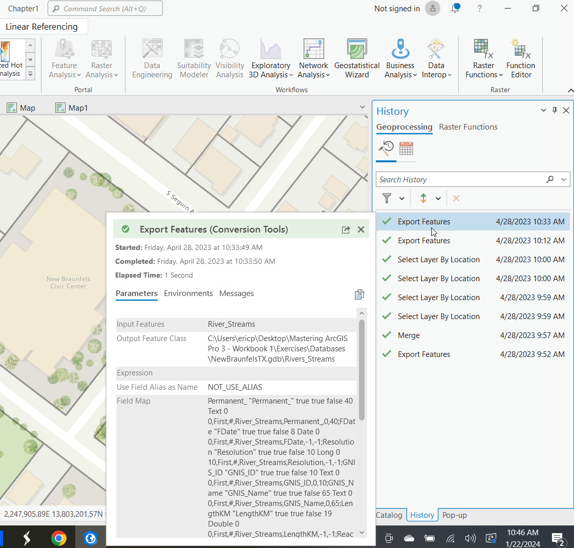
Mousing over any of the entries in the History pane will present a window with additional information about the tool execution including date/time, elapsed time, input and output parameters, environment variables and messages. You can see this displayed in the screenshot below for the Export Features tool.
The History pane can also display scheduled tools (#1 below), can be filtered (#2) , sorted (#3), and tools can be removed from the list of tools displayed (#4).

As the list of tool entries gets longer over time it is also searchable.

Double clicking any of the entries in the History pane will display the geoprocessing tool in a new pane with the parameters used for the tool when it was last run. The tool can then be re-run or you can, and often will need to, make changes to the parameters before it is run.

Right clicking any of the tool entries in the History pane will display a context menu of options. From the context menu you can open the tool, run the tool with the original parameters, add it to a model you’re building in ModelBuilder, access a variety of Python options, and more.

Conclusion
The History Pane in ArcGIS Pro is a pivotal feature that significantly enhances the efficiency, transparency, and collaborative capacity of GIS workflows. Its functionalities cater to the diverse needs of GIS professionals, educators, and learners, underscoring its importance in the realm of geospatial analysis and project management. As GIS technology continues to evolve, tools like the History Pane will remain crucial in shaping effective and efficient geospatial practices.
