ArcGIS Pro 3.2 is out, and it’s packed with some cool new features that are worth chatting about. Read below to find out more.
1. Easy Data Management
- Create Schema Reports: You can now generate a schema report of your geodatabase in different formats, such as CSV, Excel, or PDF. These reports show information on datasets and their properties, relationships, and rules.
- Edit a Single Workspace: ArcGIS Pro 3.2 lets you have more control over your editing sessions by allowing you to set your editing to a Single Workspace edit session. A workspace is the container in which your data is stored, such as a file or enterprise geodatabase. If you enable this setting, then you can manually save and discard edits from the Edit tab.

2. User Interface Just Got Better
- Keyboard Shortcuts: Customize as many keyboard shortcuts as you need and want. This includes modifying existing shortcuts or creating new ones.
- Thematic Map Series Creation: Now you can create map series where the map extent stays the same, but the data changes.

3. Updated Data Types and Formats
- New Field Data Types: New data types include Big Integer, Timestamp offset, Date only, and Time only. Big Integer can store whole numbers that exceed -2.14 billion to 2.14 billion while the Timestamp offset allows you to include a Universal Time (UTC) offset to your date/time field.
- Oriented Imagery: Managing drone and street-level images just got easier. This function allows you to flip through your geographic data like a photo album.
4. Next Level 3D Mapping
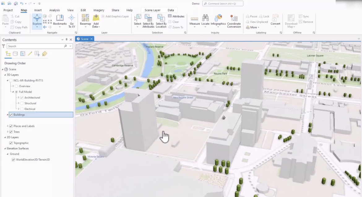
- 3D Basemaps: Add realistic 3D basemaps to your scenes.
- Save Styles from Projects: Keep your project style consistent by saving all the style items from a single project to use in other projects. This includes symbols, colors, label placement, layout items, and more.

5. Boosted Performance and Productivity
ArcGIS Pro 3.2 has focused on making things faster and more efficient. From rendering CAD text quicker to handy toggle buttons for symbol changes, it’s all about saving time and effort. Some of the new features are listed below:
- Render CAD text symbology more quickly.
- Render point clouds as squares instead of circles which boosts overall performance in a scene.
- Better Points to Line geoprocessing tool.
- A new Auto-Apply button allows you to apply symbol property changes as you make them.
- Copy and paste properties from one layer to another in the same map or different maps.
- Calculate statistics on attribute table fields without creating a chart.
6. Better Geoprocessing
- Enhanced Geoprocessing Tools: Many tools now support new field data types, making your data analysis even more robust.
- Charts and Visualization Upgrades: More options for pie charts, histograms, and temporal charts to help you visualize your data.
7. Python and ModelBuilder Integration
- Python Enhancements: Send code from geoprocessing history to a notebook for future use and recording and standardizing your process protocol.
- ModelBuilder Improvements: Find and replace filters, new parameters, and better iterate time tool settings.
8. Raster and Point Clouds
- New Raster Functions: More functions are being provided to help you get more creative with gradient calculations, region pixel counts, and SAR indices.
- Point Cloud Data Handling: New tools have been added for Deep Learning with Point Clouds. These tools help train your models for object detection and extraction in point clouds.
9. Spatial Stats and Tools
- Spatial Join Enhancements: Filter spatial join results with the Matching Attributes parameter. This allows you to fine-tune your results even further.
- Aviation Data Tools: Generate and edit airspace lines with more precision.
10. Advanced Features for GIS Pros
- Custom Vertical Transformation Creation: You can now create custom transformations between vertical coordinate systems.
- Project Tool Enhancements: You now have the flexibility to use OGC GeoPackage files and memory workspace datasets as input and output.
Wrapping Up
With these new features in ArcGIS Pro 3.2, you’re all set to take your GIS projects to new heights. We hope you find this summary useful.
For more details, check out the official ArcGIS Pro 3.2 documentation or the Esri ‘what’s new’ video.

