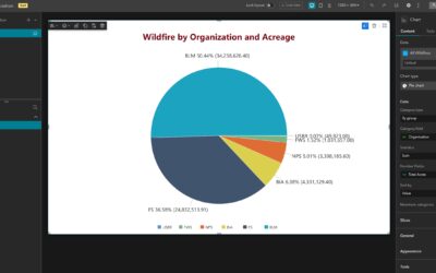
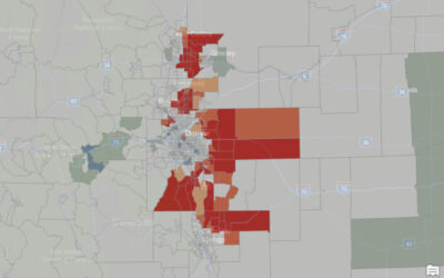
Learn more about our Experience Builder courses and upcoming training schedule. In a previous tutorial, we described the steps and options for configuring a modern pie chart in Experience Builder. In this tutorial, we will use Wildfire data from between 1984 and 2016...
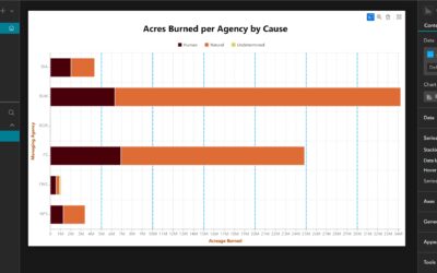
How to Customize a Stacked Bar Chart with a Split-By in Experience Builder
read more