Training a Deep Learning Model using Drone Imagery and ArcGIS Pro
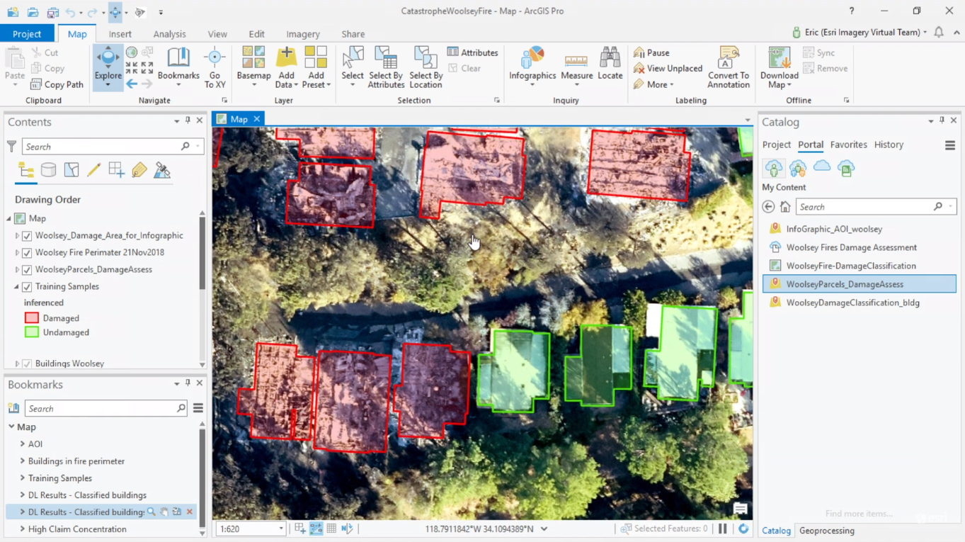
This year’s Esri User Conference plenary sessions featured a presentation showing how an insurance company in San Antonio, Texas uses ArcGIS Pro to train neural deep learning networks, in order to automate and speed up damage assessment and building footprint...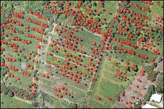
ArcGIS Pro 2.3 Introduces New Deep Learning Tools
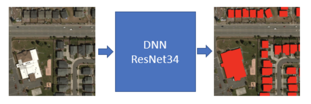
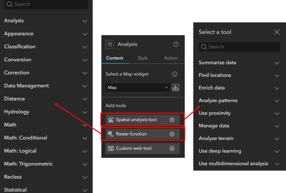
The latest version of ArcGIS Pro features new deep learning tools that let users train their data in an external deep learning model and use the results to model or classify their imagery within the ArcGIS platform. What is deep learning and how can it improve...