

Viewing data summaries can be powerful, but spatial analyses can provide an even deeper understanding of data, relationships, and location. I won’t go into detail about the benefits of spatial analysis because I would be preaching to the choir. Because of this, I will skip ahead to the juicy part, which is a quick overview of the most important information associated with the Analysis Widget in Experience Builder. In this short article we will cover what you can do with the Analysis widget, what level of licensing is required, and how to determine the credit consumption of the tools at runtime.
What can I do with the Analysis Widget?
You can add more than 60 spatial analysis tools and over 100 raster functions to your Experience Builder applications through the Analysis Widget. You can summarize and enrich data, analyze patterns, calculate proximity, analyze terrain, use deep machine learning, and more. The below lists contain the categories of analyses and functions that can be performed at this time.
Spatial Analysis Tools
- Summarize Data
- Find Locations
- Enrich Data
- Analyze Patterns
- Use Proximity
- Manage Data
- Analyze Terrain
- Use Deep Learning
- Use Multidimensional Analysis
Raster Function Tools
- Analysis
- Appearance
- Classification
- Conversion
- Correction
- Data Management
- Distance
- Hydrology
- Math: Conditional, Logical, Trigonometric
- Reclass
- Statistical
- Surface
What do my users see?
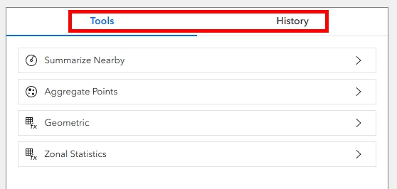
Once you have chosen which analysis tools to provide, your users will have the option to perform them at runtime. The Analysis panel will provide two tabs, the Tools tab and the History tab. The Tools tab lists the items you provided to your users when you configured the widget, while the History tab records the log of tools that have been run. From the History log, the user has the option to view the parameter details of the tool when it was run, open the tool again, or delete it from the list.
What level of licensing is required?
To use the Analysis Widget, users must be logged into ArcGIS Online with an account that has the minimum required privileges. These privileges may vary depending on the Analysis or Raster Function being performed. For Raster-specific Functions and Analyses, the organization who owns the application must have ArcGIS Image for ArcGIS Online and users must also be assigned privileges within ArcGIS Image.
For all other analyses, the user must be able to create, update, and delete content as well as publish features and run analyses. This means they must have at least the following:
- Creator or GIS Professional user type
- Publisher, Facilitator, or Administrator role, or an equivalent custom role
How do I figure out how many credits a tool will consume?
Running analysis tools in any ArcGIS Online application will consume credits at runtime. These same analyses will not consume credits in ArcGIS Pro. Because of this, it will be important to consider whether your users can access and run certain analyses in ArcGIS Pro instead of within your Experience Builder application. However, the benefits of providing these analysis tools in a single, streamlined application are many and often the only option.
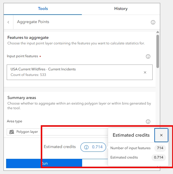
Users will have the ability to estimate credit usage prior to running the tool by clicking the link at the bottom of the panel (above the Run button) that says, “Estimate Credits”. Often, the complexities of credit calculations on the backend remain a mystery, so the ability to calculate credit consumption at runtime is key. The credits will vary based on the tool being run, the size of the data or number of input features.
Summary
The benefits of using the Analysis Widget extend beyond the basics of data summary and visualization. And though it is easy to configure in your Experience Builder layout, there are complexities that need to be researched before implementing the Analysis widget. The ability to preview your applications and estimate credit usage before publishing will be important so that you can appropriately budget for and allocate credits for your users. It is also important to ensure the minimum requirements for licensing and role privileges are set in place before your users can begin to utilize the application for its intended purpose.
