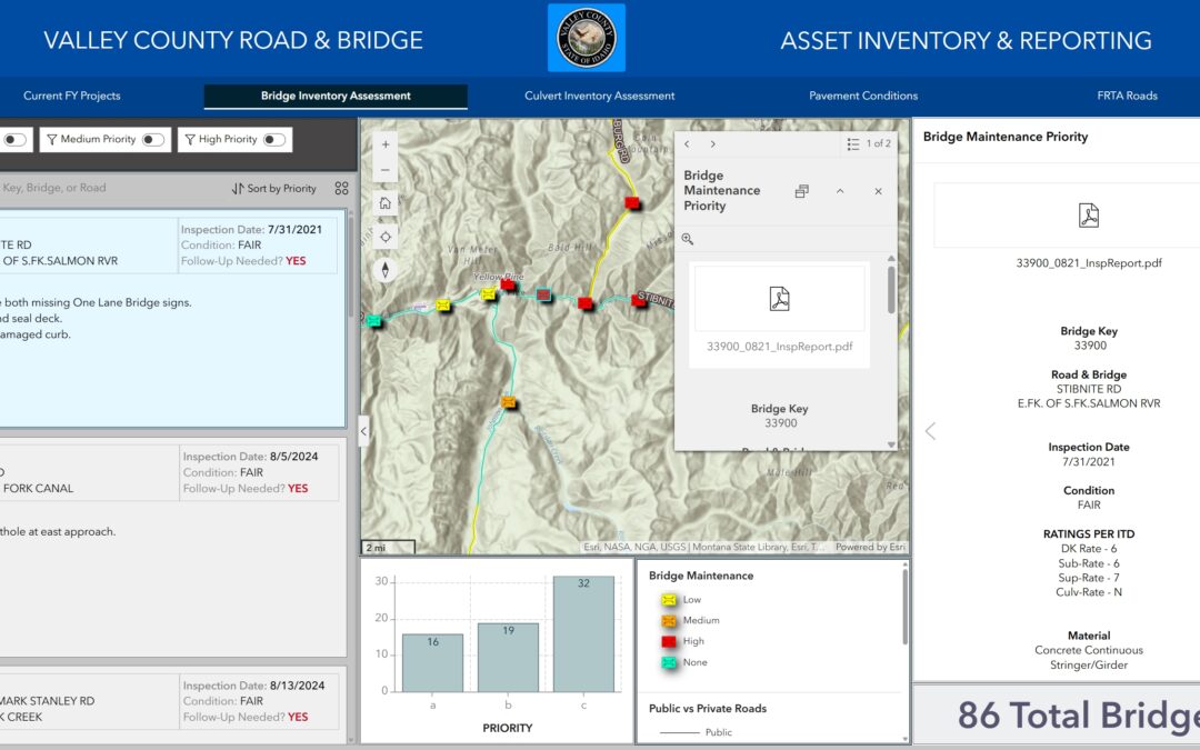
Widget-Driven Design for Storytelling with Experience Builder
Storytelling in GIS involves creating engaging narratives that link spatial data with visuals and meaningful insights. Experience Builder offers a range of widgets to help users design interactive, visually compelling applications for storytelling. In this tutorial,...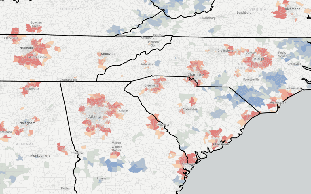
Using ArcGIS Pro’s Hot Spot Analysis Tool to Examine Population Change (2018–2023)
Don’t forget that you can save 20% on our self-paced, live-online, and in-person GIS training through December 31st by using the discount code 20for20. Discount already applied to the Annual GIS Training License. Population growth and decline are dynamic trends...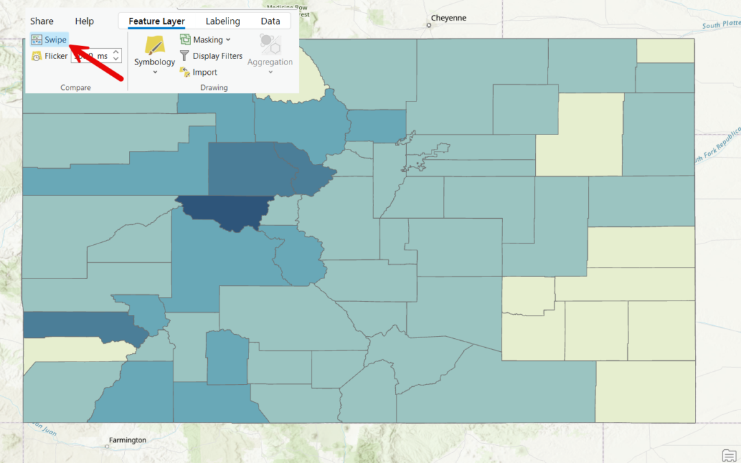
Discover the ArcGIS Pro Swipe Tool: A Game-Changer for Layer Comparisons
Don’t forget that you can save 20% on our self-paced, live-online, and in-person GIS training through December 31st by using the discount code 20for20. Discount already applied to the Annual GIS Training License. GIS is all about visualizing and analyzing...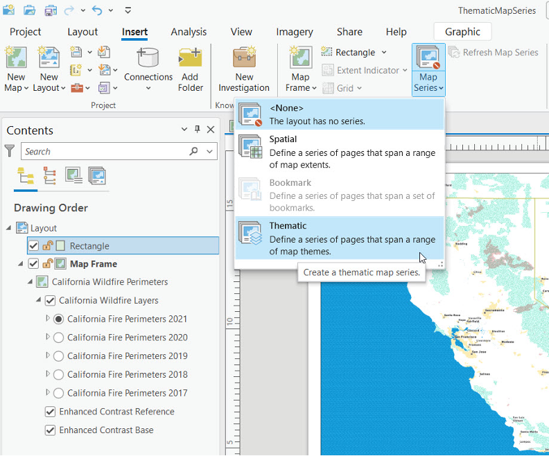
Step Up Your Mapping Game: Creating Thematic Series in ArcGIS Pro
Save 20% on our GIS classes during our annual holiday sale through December 31st. Simply enter the discount code 20for20 when checking out online. Discount already applied to the Annual GIS Training License. View our full catalog of classes and bundles. When it...