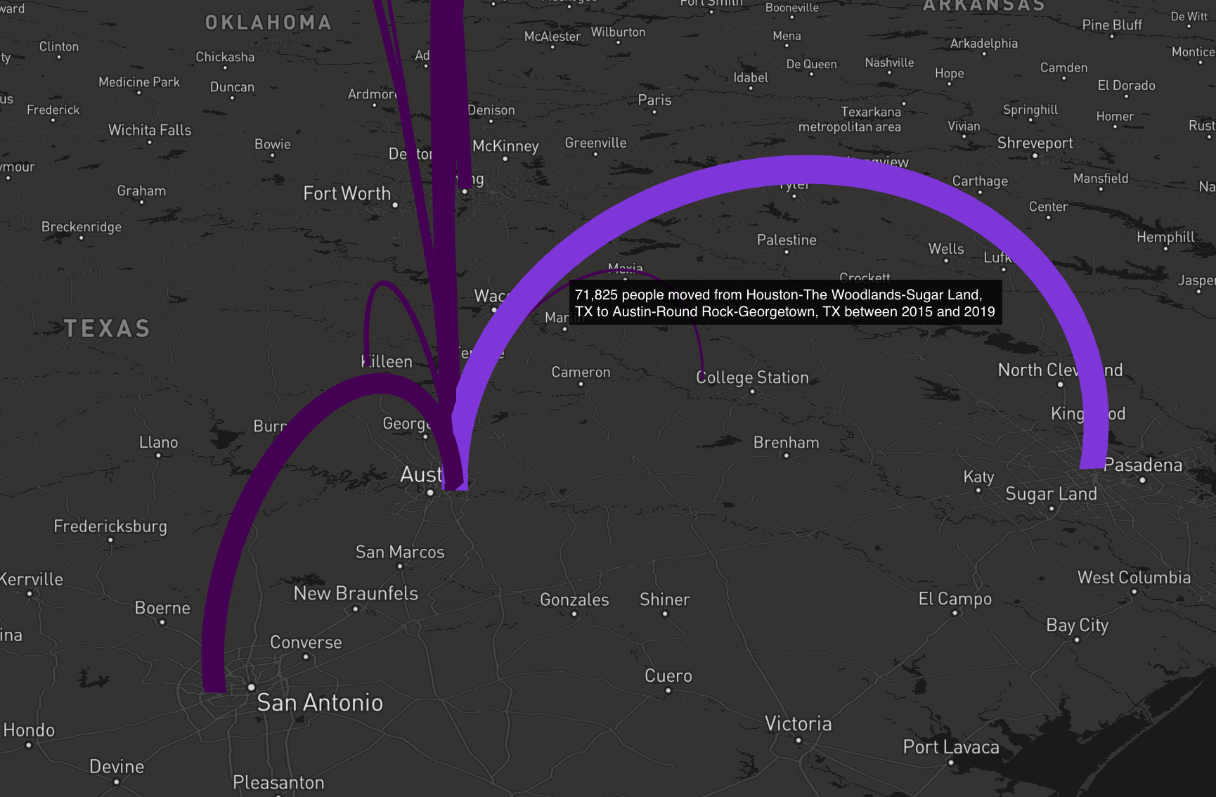
Tutorial: Mapping Migration Flows with R
The American Community Survey Migration Flows dataset estimates the number of people that have moved between pairs of places. The estimates are calculated based on where a person lived when surveyed and where they lived one year prior to being surveyed. The data is...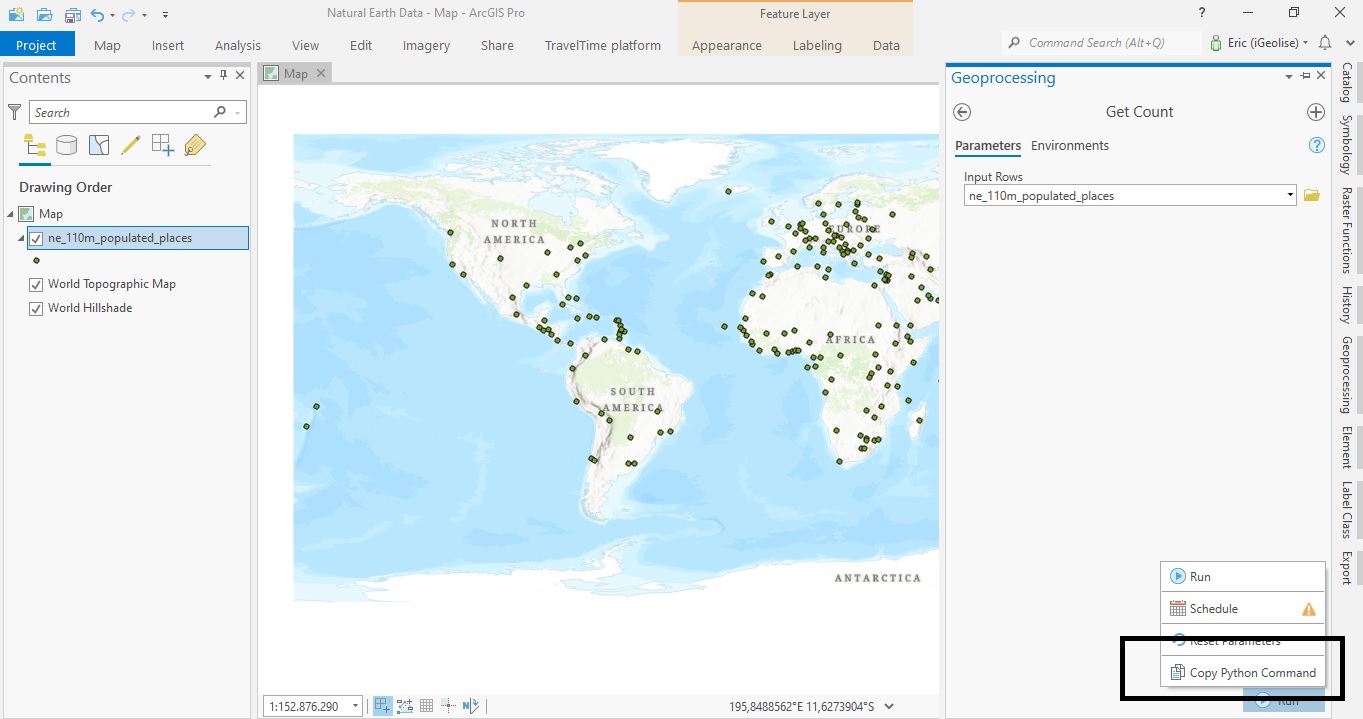
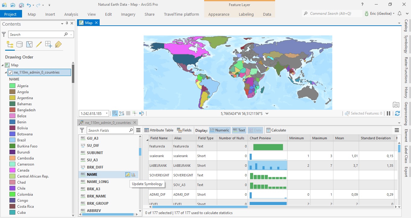
ArcGIS Pro 2.8’s New Copy Python Command
ArcGIS Pro 2.8 comes with a new handy feature that copies the Python command when running a geoprocessing tool inside Pro. This tutorial shows how the tool works, describes some best use cases and how the interpret the results. Pro 2.8 introduces a new handy feature...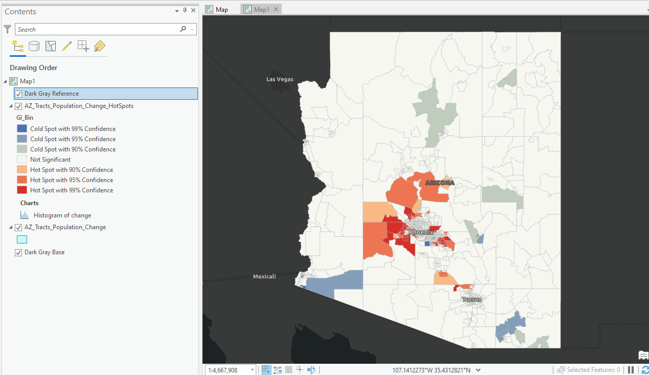
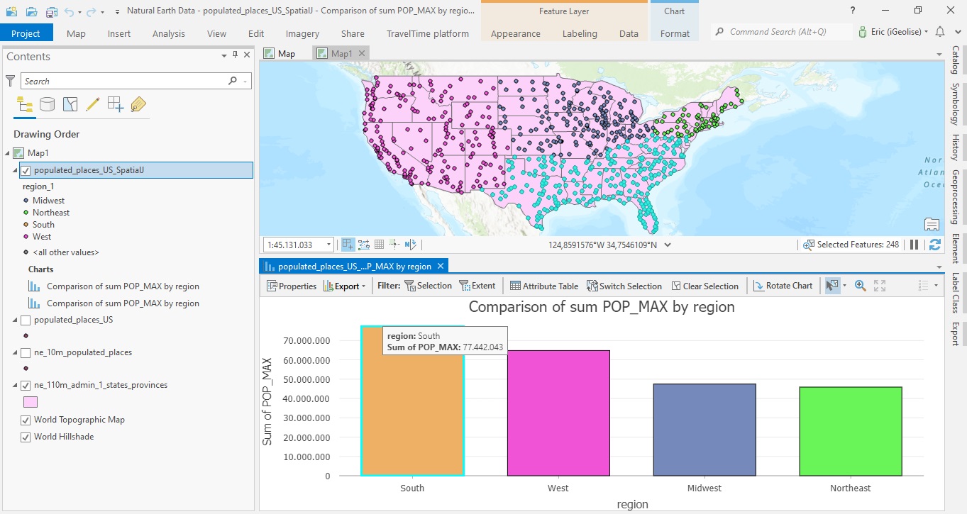
Mapping Population Growth Hot Spots with R and ArcGIS Pro
This tutorial demonstrates how to use R and ArcGIS Pro to generate hot spot maps of population growth by census tract. In a previous article I showed you how to use the tidycensus R package to quickly access and map US census data. You can also download a free copy of...