Introducing Spatially Enabled DataFrames
The new 1.5 release of the ArcGIS API for Python finally allows users to read spatial data as pandas DataFrame objects. As a result, manipulating geometric and attribute information of spatial data has become a lot easier. Although previous versions of Esri’s ArcGIS...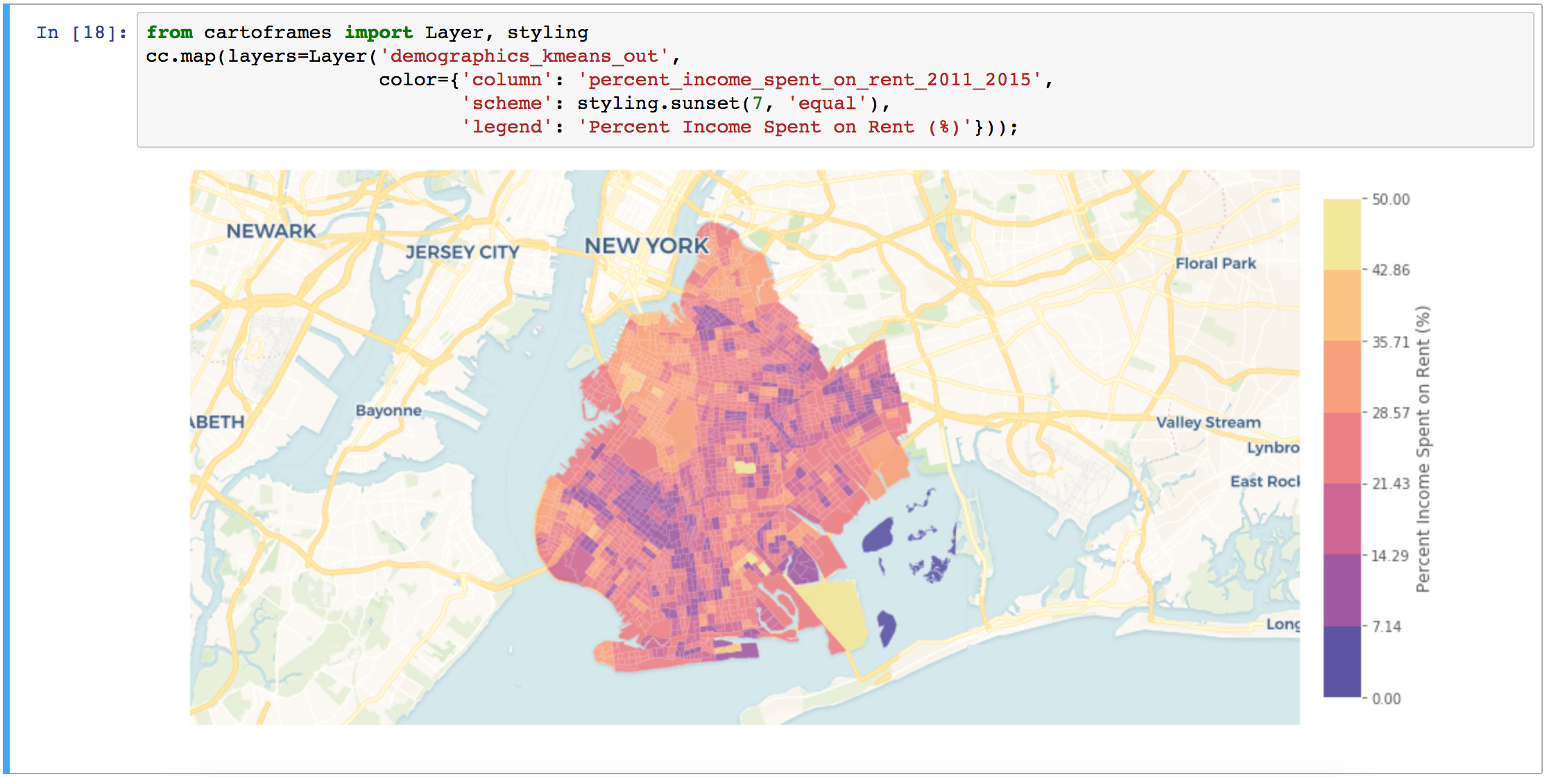
How to Add GIS to your Data Science Skills
During our 14th Annual Anniversary Sale you can save up to 25% on GIS training. As we´ve seen in the first article, the future for data scientists looks bright. Here, we´ll cover how GIS technology can enhance the skillset of any data scientist. As discussed in the...
How to Add Data Science to your GIS Skills
GIS professionals interested in data science can start their journey into this field by exploring various spatial data analysist tools offered by ArcGIS and learning how to code. Current GIS software offers many tools that fall into the data science category. As such,...
Why the Future Looks Bright for Data Scientists
A recent study from job site Glassdoor showed that data scientist is currently the best job to apply for, offering a median base salary of $110,000 and job satisfaction of 4.4 out of 5. Let´s have a look at the different types of data scientists and the required...