
Tutorial: Adding Data to a Map in ArcGIS Pro with Python
In this tutorial, you’ll learn multiple ways to add data to a map using Python. Specifically, we’ll add single shapefile feature classes and folders containing shapefile feature classes to the map using both arcpy and the os module. There are various ways to add data...
Create a Script Tool in ArcGIS Pro from a Python Script
In this tutorial, you’ll learn how to create a script tool in ArcGIS Pro from a standalone Python script. A script tool is a Python script file that can be run as a geoprocessing tool. This means you only have to worry about setting the right parameters of the tool...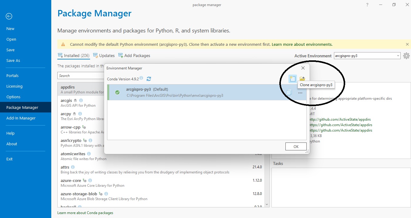
Tutorial: Managing Python Packages with Pro’s Package Manager
In this tutorial, we’ll have a look at Pro’s new Package Manager. This package management system lets us install, update and delete Python packages that are grouped into separate, named Python environments. What is Pro’s Package manager and what is it used for? ArcGIS...
Tutorial: Using Python to Find Identical Features in a GIS Dataset
In this tutorial you’ll learn how to identify duplicate entries in a GIS dataset using ArcGIS Pro Python Notebooks. If you want to use Python to find duplicate entries in a feature dataset, there are several ways to do so. This tutorial features two...