Working with Jupyter Notebooks inside of ArcGIS Pro
The latest release of Pro integrates Jupyter Notebooks. This blog post describes the benefits of integrating them in Pro projects and workflows. The 2.5 release of Pro comes with the Juypter Notebooks application installed. What’s more, Jupyter Notebooks have been...
What’s New in ArcGIS Pro 2.5
Esri has launched a new version of ArcGIS Pro, 2.5. This new version contains many improvements which I think you all might find useful. In general terms, ArcGIS Pro has achieved about 95% functionality equality with ArcMap and ArcCatalog. In some areas, ArcGIS Pro...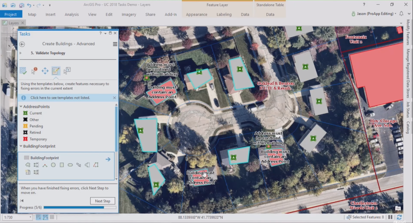
How to Share Tasks with Other ArcGIS Pro Users
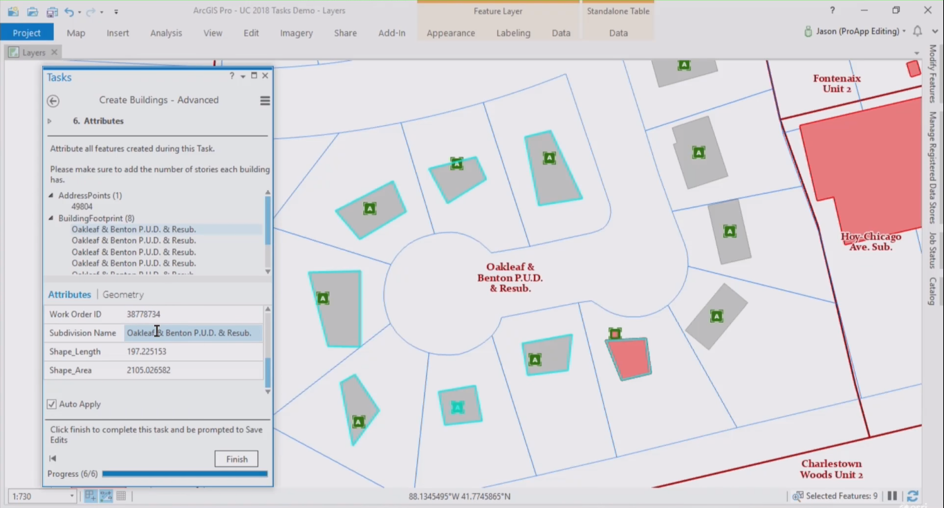
This blog post describes how to export ArcGIS Pro Task items and share them with users inside and outside of an organization. Sharing a task through a project package There are various ways to share task items or task steps. The first way is to share a task as a...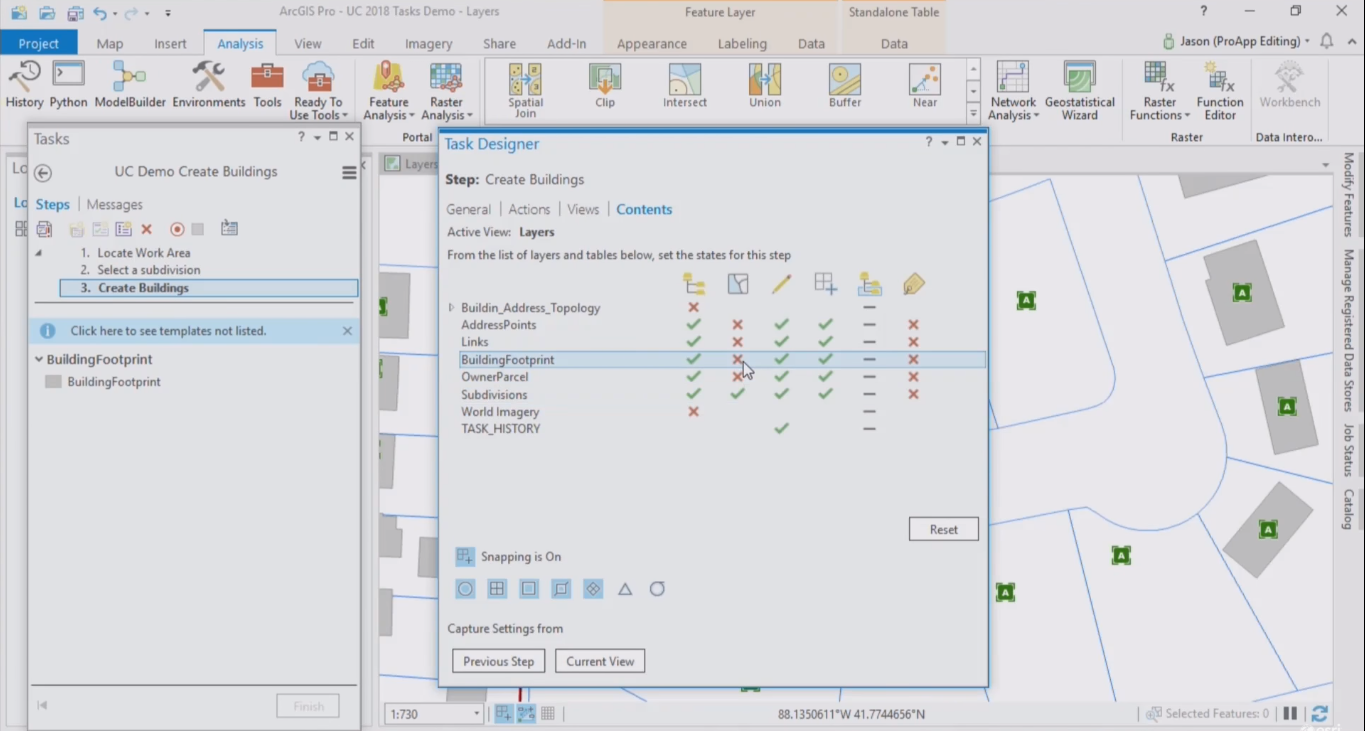
Creating a New Task Item in ArcGIS Pro
This article explains how to create a new task item in ArcGIS Pro. Also, some advice is offered before considering the creation of a new task. Creating a new task item Creating a task starts with creating a new task item inside a project in Pro. Tasks are listed in...