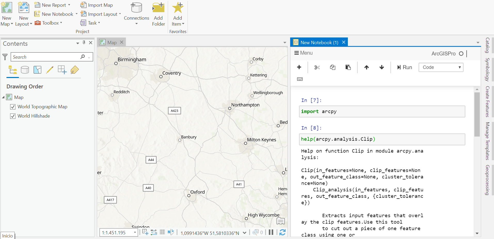
ArcGIS Notebooks in ArcGIS Pro
Since the release of ArcGIS Pro 2.5, a new feature called ArcGIS Notebooks is supported. The concepts behind this feature are discussed below. What are ArcGIS Notebooks? ArcGIS Notebooks are integrated Jupyter Notebooks inside of Pro. A Jupyter Notebook is...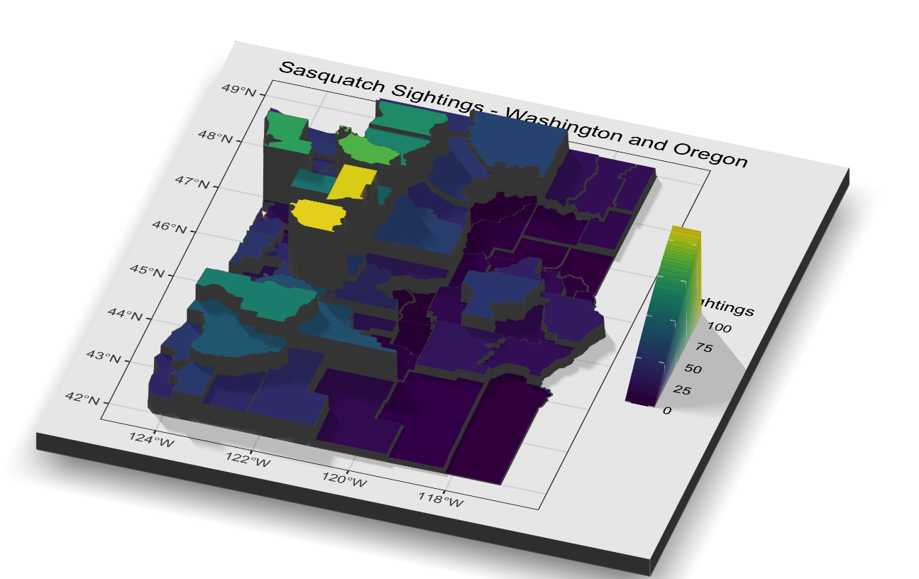
3D Mapping of Sasquatch Sightings in R with Rayshader
Prior articles in this series Introduction to GIS Analysis using Sasquatch SightingsSpatial Squatch – Using the ArcGIS Pro Spatial Statistics Toolbox to Identify Sighting PatternsMapping Clusters of Sasquatch SightingsSasquatch Sighting Heat Maps with R In this...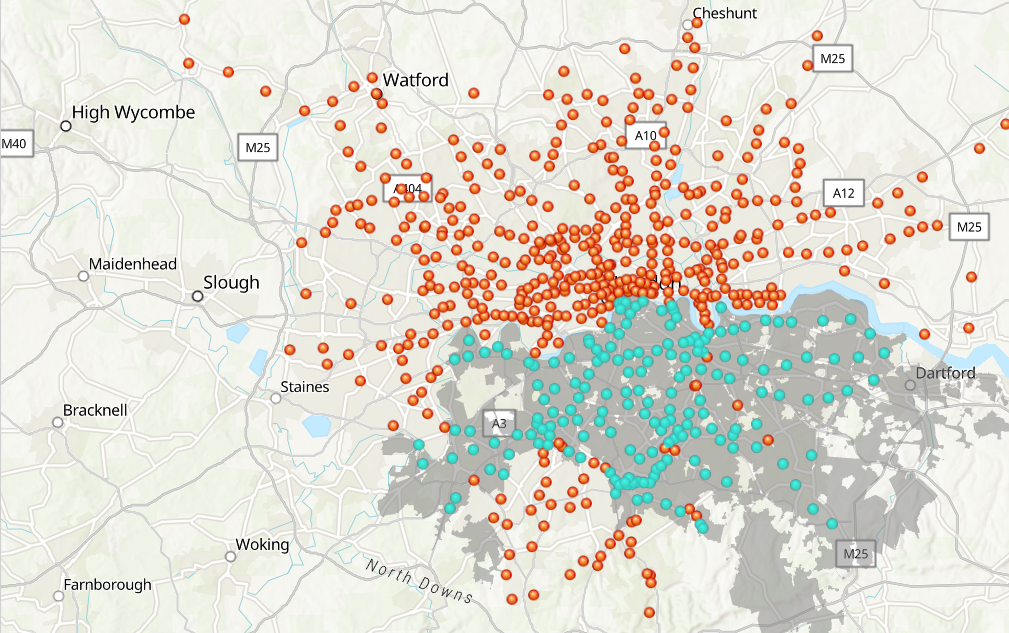
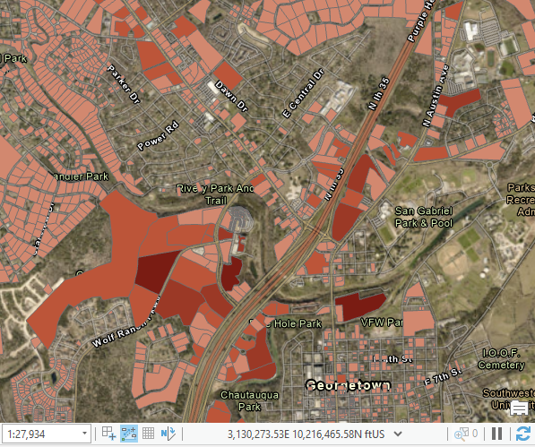
How to Select Features in ArcGIS Pro
Check out our self-paced GIS training bundles. Selecting features on a map or from a feature attribute table is an important task, whether you are editing or analyzing a selection of your data. There are multiple ways to do this in ArcGIS Pro, as illustrated below....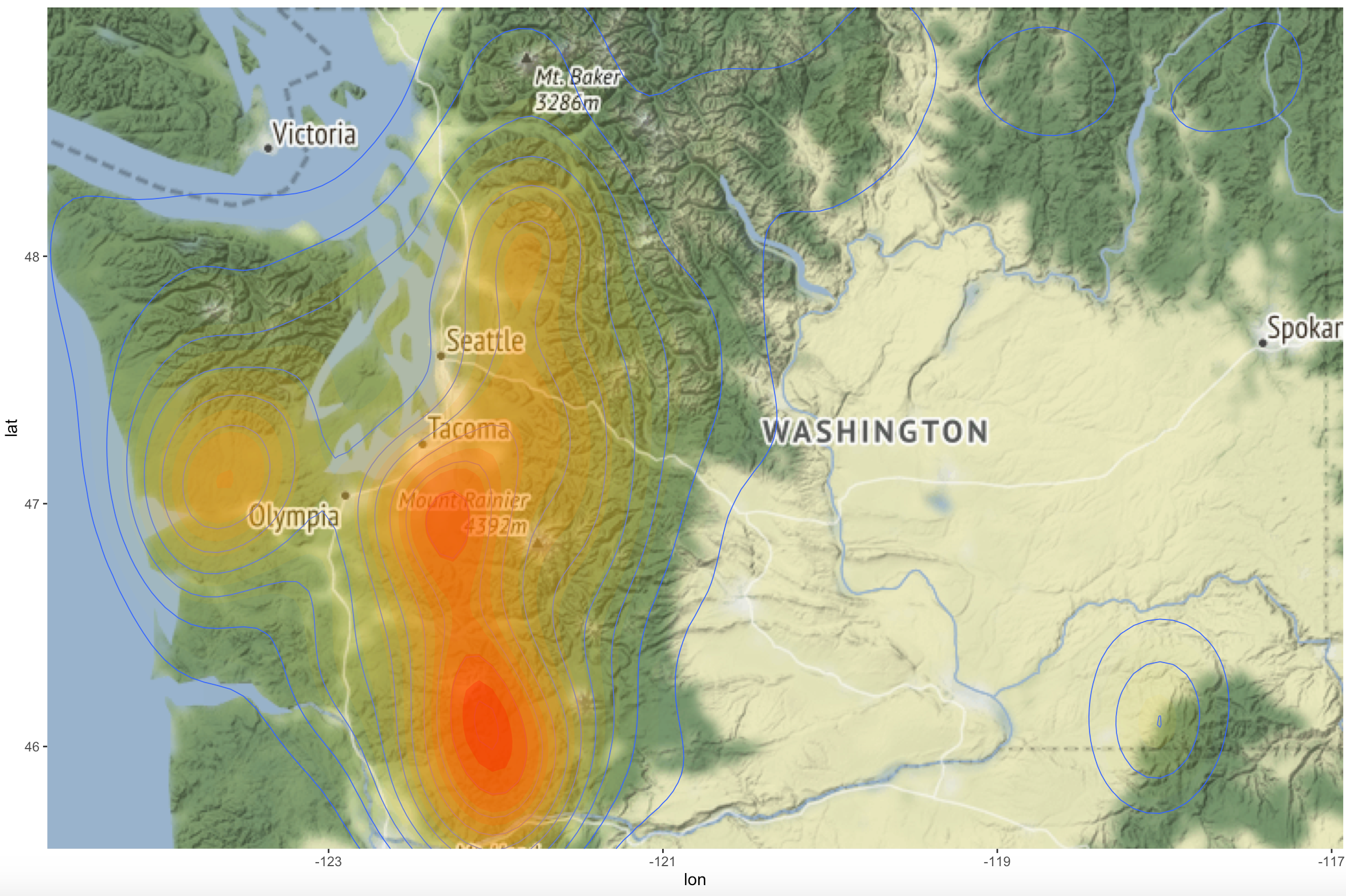
Sasquatch Sighting Heat Maps with R
Prior articles in this series Introduction to GIS Analysis using Sasquatch SightingsSpatial Squatch – Using the ArcGIS Pro Spatial Statistics Toolbox to Identify Sighting PatternsMapping Clusters of Sasquatch Sightings In this article I’ll deviate a little from...