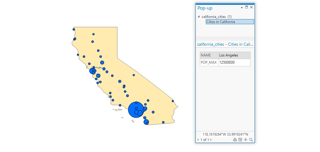
Tutorial: Configure and Display Pop-ups in ArcGIS Pro
In this tutorial, we’ll learn how to configure and display simple pop-ups for feature layers. In Pro, pop-ups can be configured to display information about individual map features. Rather than statically displaying this information on a map, the user can click on a...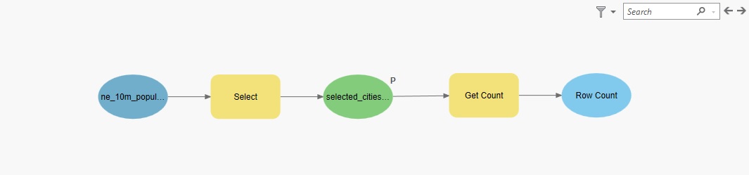
Tutorial: Visualize and Reuse GIS Workflows with Model Builder in ArcGIS Pro
In this tutorial, we’ll use Pro’s Model Builder to create a reusable workflow. Pro’s Model Builder is a visual workflow tool lets you automate GIS workflows. You can use it to chain the input and output of multiple geoprocessing tools, and save that for future use. In...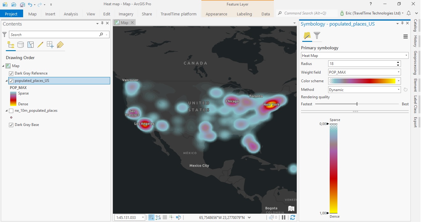
Tutorial – Creating a Heat Map in ArcGIS Pro
In this tutorial, you will learn how to create a heat map in ArcGIS Pro. This heat map will display the distribution of individual points that represent populated areas in the US. Using population values as a weight field, we can visualize the highest populated areas...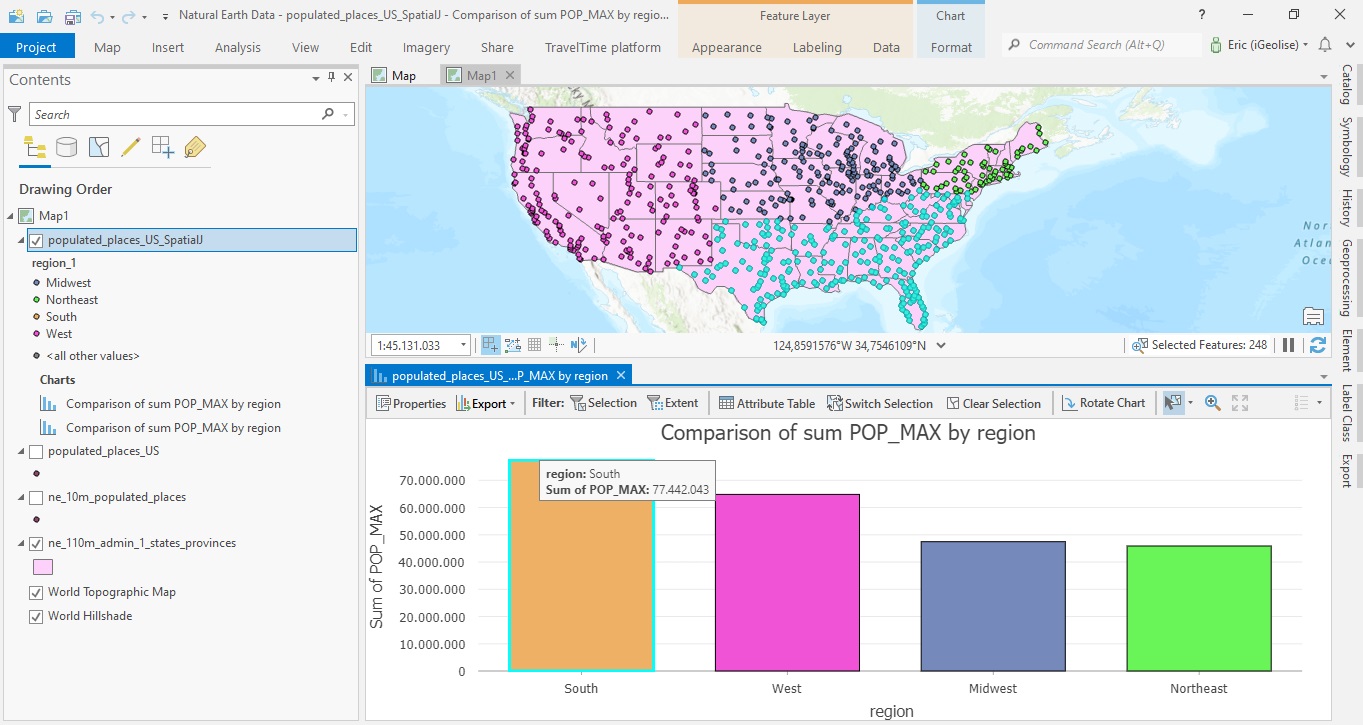
Combining Multiple Spatial Analysis tools in ArcGIS Pro
The following tutorial uses multiple spatial analysis tools to be able to compare population counts for the four different regions in the US. When doing spatial analysis, you often must combine multiple tools to be able to find a solution to a specific problem. This...