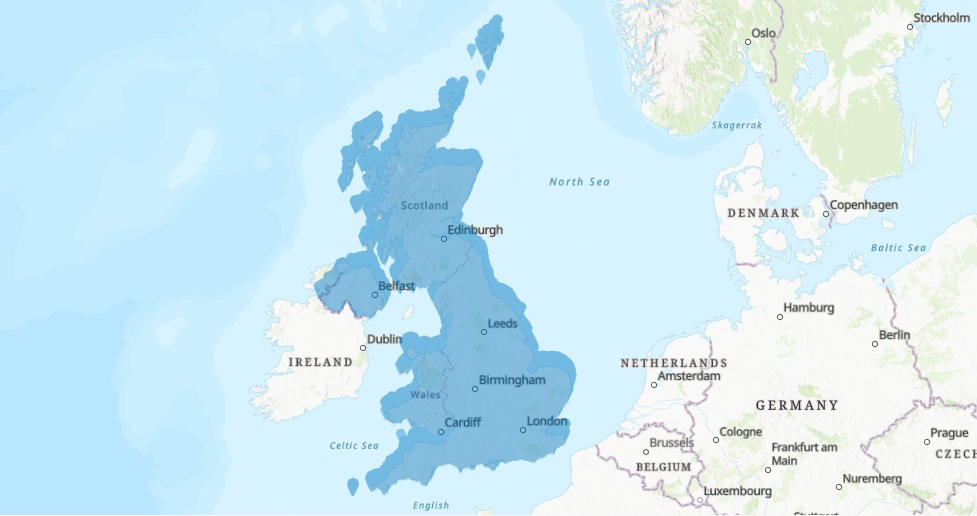
Setting A Map Projection for Single and Multiple Layers in ArcGIS Pro
In this tutorial, we’ll add an XY-value dataset to ArcGIS Pro and show how to project a single map layer and set the projection for multiple layers inside a map. Introduction Often, you will need to work with spatial data from outside your organization. You will have...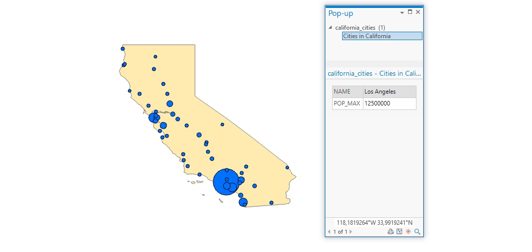
Tutorial: Configure and Display Pop-ups in ArcGIS Pro
In this tutorial, we’ll learn how to configure and display simple pop-ups for feature layers. In Pro, pop-ups can be configured to display information about individual map features. Rather than statically displaying this information on a map, the user can click on a...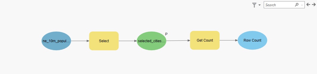
Tutorial: Visualize and Reuse GIS Workflows with Model Builder in ArcGIS Pro
In this tutorial, we’ll use Pro’s Model Builder to create a reusable workflow. Pro’s Model Builder is a visual workflow tool lets you automate GIS workflows. You can use it to chain the input and output of multiple geoprocessing tools, and save that for future use. In...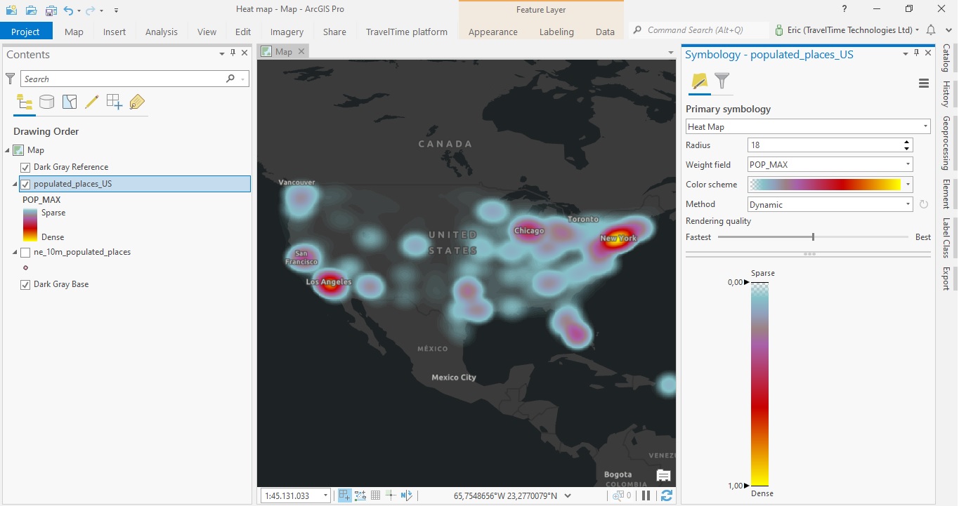
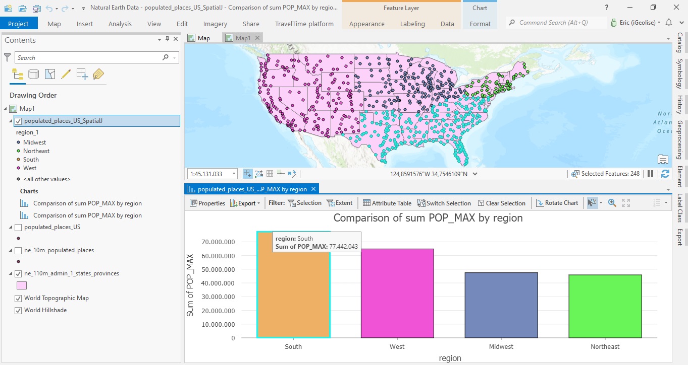
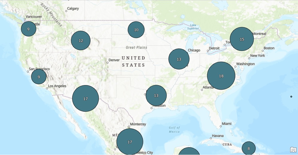
Tutorial – Creating a Heat Map in ArcGIS Pro
In this tutorial, you will learn how to create a heat map in ArcGIS Pro. This heat map will display the distribution of individual points that represent populated areas in the US. Using population values as a weight field, we can visualize the highest populated areas...