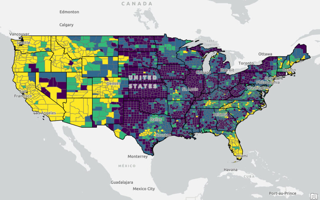
Using Python, ArcGIS Pro and ACS Data to model Population Shifts in the Western US
Over the last five years, the western United States has experienced notable shifts in population patterns, with distinct regions emerging as either growth hot spots or cold spots. Cities like Denver, Colorado, and Boise, Idaho, have seen substantial population...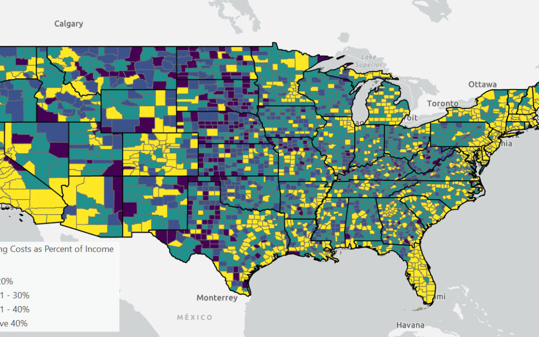
From Bad to Worse: The Escalating Cost Burden on American Renters
In 2022, according to the latest U.S. Census Bureau data, 44% of American renters allocated 30% or more of their income to housing costs, with 23% spending at least half of their income on housing. This level of expenditure classifies them as “cost...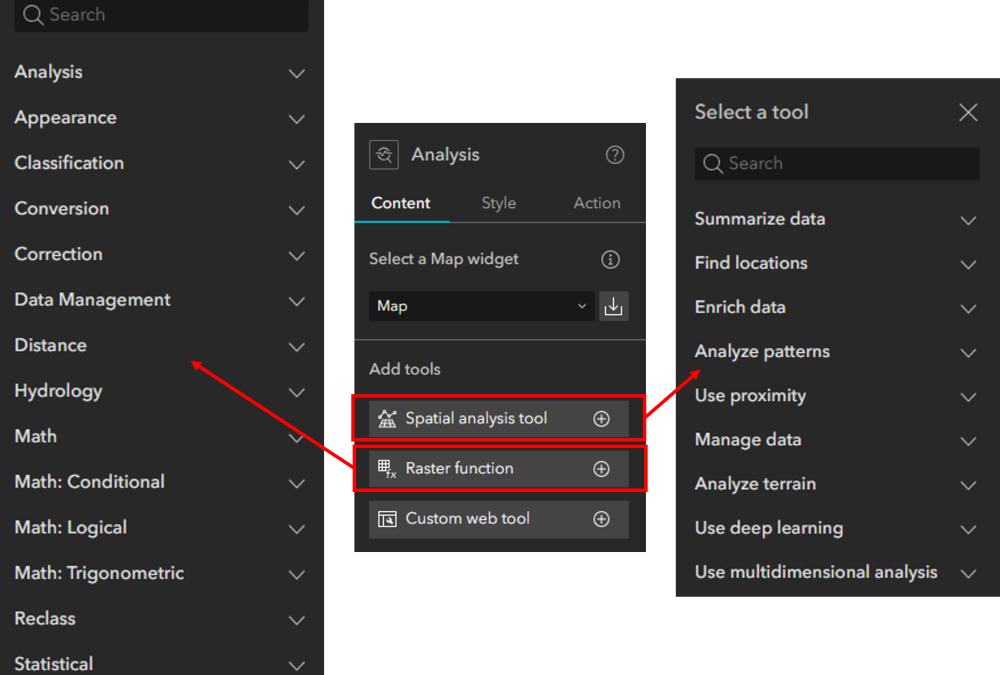
Analysis Widget Overview for Experience Builder
Viewing data summaries can be powerful, but spatial analyses can provide an even deeper understanding of data, relationships, and location. I won’t go into detail about the benefits of spatial analysis because I would be preaching to the choir. Because of this,...
Tutorial: Simplifying Point Layer Visualization with ArcGIS Pro’s Aggregation Tool
ArcGIS Pro offers two powerful methods for dynamically aggregating point feature layers: binning and clustering. While both are visualization techniques that aim to simplify and summarize data, they differ in their representation and behavior. For point feature...