Create an Awesome Layout with the Blank Grid Template in Experience Builder
Learn more about our Experience Builder courses and upcoming training schedule. In all our years building applications with Experience Builder, we have found that the Layout widget options have been lacking. Aside from the Sidebar widget, which is a fantastic addition...
Holy Globe, Batman! Experience Builder just got even more amazing.
Learn more about our Experience Builder courses and upcoming training schedule. As usual, my finger became exhausted when scrolling through ESRI’s “What’s New in Experience Builder” page. Not that I’m complaining about the lengthy list of...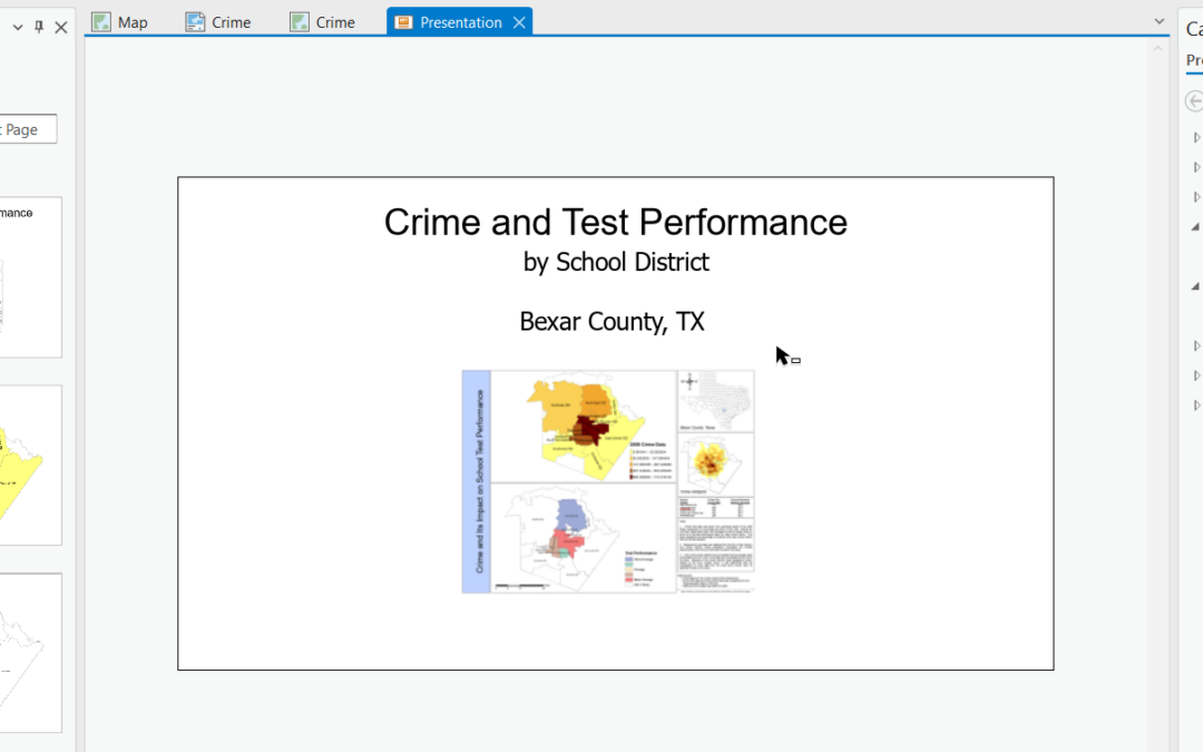
Unlock the Power of Storytelling with Presentations in ArcGIS Pro 3.3
Effective communication of data and insights is crucial to GIS professionals. ArcGIS Pro 3.3 introduces an exciting feature that revolutionizes the way we present geographic information: interactive presentations. Whether you’re a GIS professional, educator, or...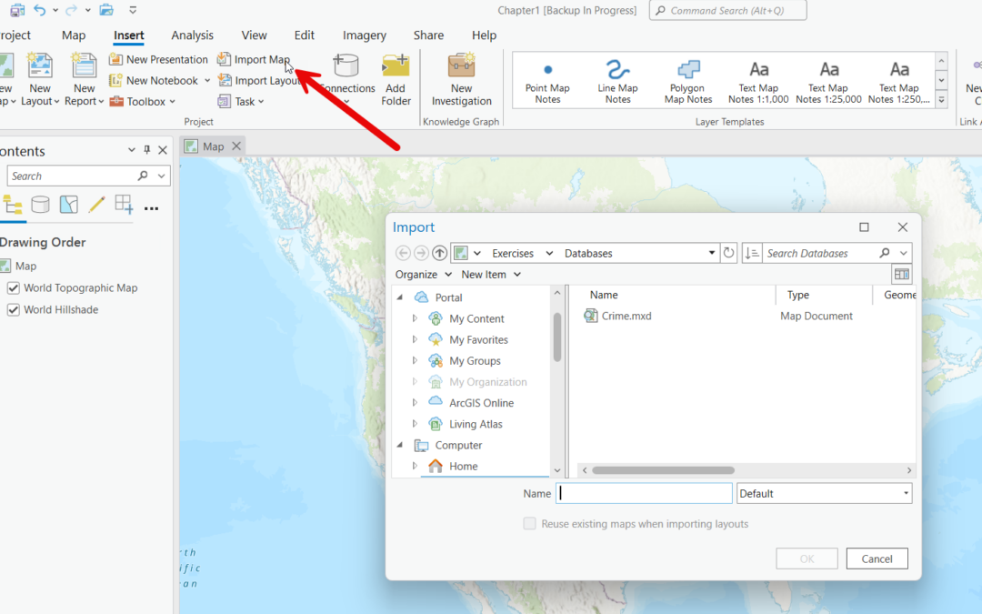
Effortlessly Import ArcMap Content into ArcGIS Pro
Transitioning from ArcMap to ArcGIS Pro marks a significant step forward in the world of GIS, bringing enhanced capabilities, a modern interface, and improved performance. However, one of the key challenges users face is effectively importing existing maps and layouts...