
What’s New in ArcGIS Pro 3
Esri has just released a major version of ArcGIS Pro. We’ll have a look at some important new features below. Version 3.0, released in June 2022, is a major update of Pro, which means new functionality, a new design and more. Here are some of the highlights of the new...
Tutorial: Using Python to Find Identical Features in a GIS Dataset
In this tutorial you’ll learn how to identify duplicate entries in a GIS dataset using ArcGIS Pro Python Notebooks. If you want to use Python to find duplicate entries in a feature dataset, there are several ways to do so. This tutorial features two...
Tutorial: Finding Identical Features in a Dataset with ArcGIS Pro
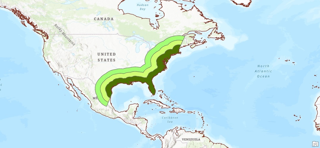
In this tutorial, we’ll explain how you can find identical features (also known as duplicate data) in a feature dataset. Step 1: Download the data We will use the Natural Earth quick start kit. In the tutorial covering bar charts using the matplotlib Python...
URISA – GIS-Pro 2022 in Boise, ID
Geospatial Training Services will be teaching Getting Started with ArcGIS Arcade, Introduction to Experience Builder, and Automating Map Production with Map Series and Python in ArcGIS Pro at the URISA 2022 GIS Pro Conference in Boise.