Our New Book – Fundamental ArcGIS Pro Skills: Workbook 1
Our new Fundamental ArcGIS Pro Skills: Workbook 1 has been published! If you’re ready to learn the basics of ArcGIS Pro including working with maps and layers, projects, and layouts this is the place to start! What you’ll learn in this book: In this book you...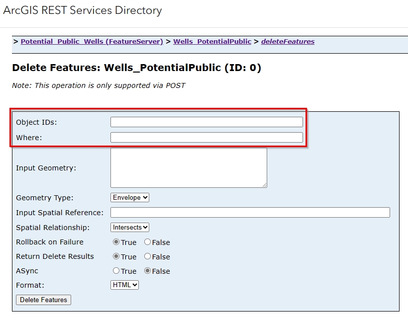
Multiple Ways to Mass-Delete Attribute Table Records
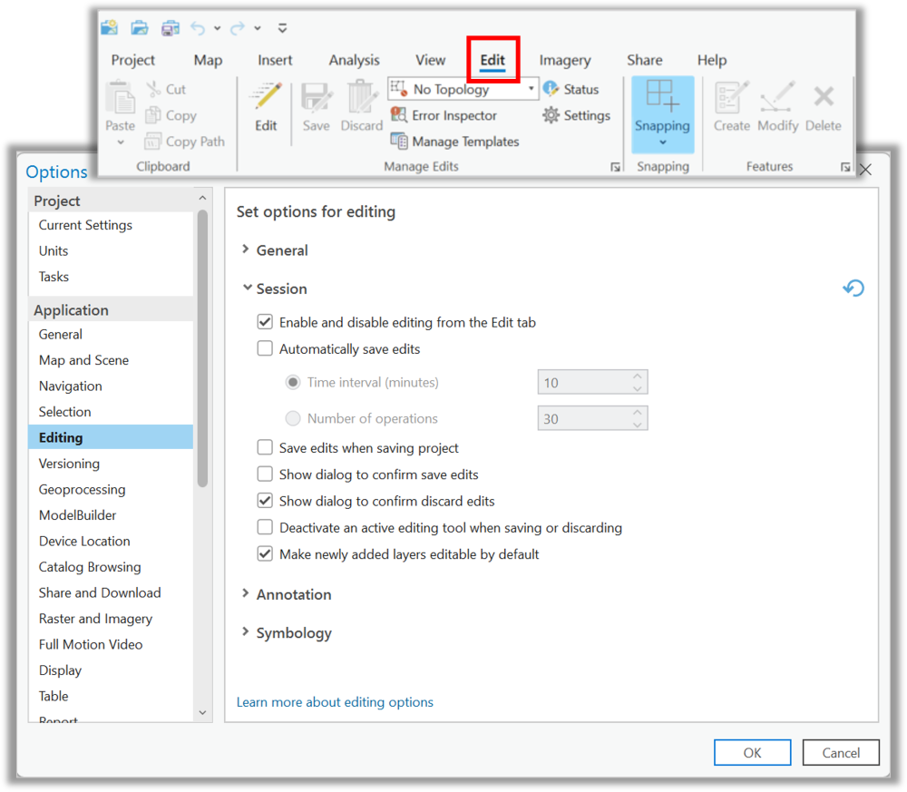
Does this sound familiar? You are in ArcGIS Pro, and you have just used Select by Attributes to select hundreds, or even thousands, of records from a feature layer or hosted feature service because you need to delete them. You click on that easily accessible red...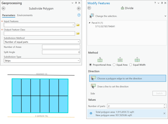
How to quickly divide a polygon into equal areas in ArcGIS Pro
There are many reasons you might want to divide an already-existing polygon into equal parts. One example is that a parcel of land needs to be subdivided for development. Another example involves research scientists and their need to create adjacent quadrants of a...
Sample Chapter 1: Fundamentals of the Python Language
The following is a sneak peek at the first part of a sample chapter from our newest book: Programming ArcGIS Pro with Python: 3rd Edition. This book has been updated for ArcGIS Pro 3.x, and will teach you how to automate your ArcGIS Pro 3.x geoprocessing tasks using...