
4 New Training Bundles – Self-Paced and Live-Online
Today we’re announcing the availability of 4 new GIS training bundles for both self-paced and live-online GIS training opportunities. These new bundles will supplement our 2 existing bundles, and provide you with the ultimate flexibility for obtaining the latest...
1400+ Addresses for Government ArcGIS Servers
Joseph Elfelt of MappingSupport.com has posted a new PDF file containing URLs for local, state, and federal ArcGIS Servers with open data. Here is the updated list: https://mappingsupport.com/p/surf_gis/list-federal-state-county-city-GIS-servers.pdf The primary...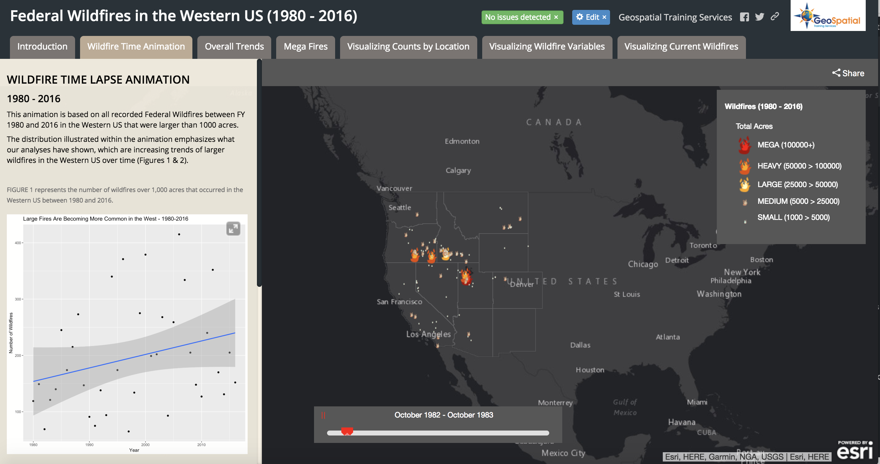
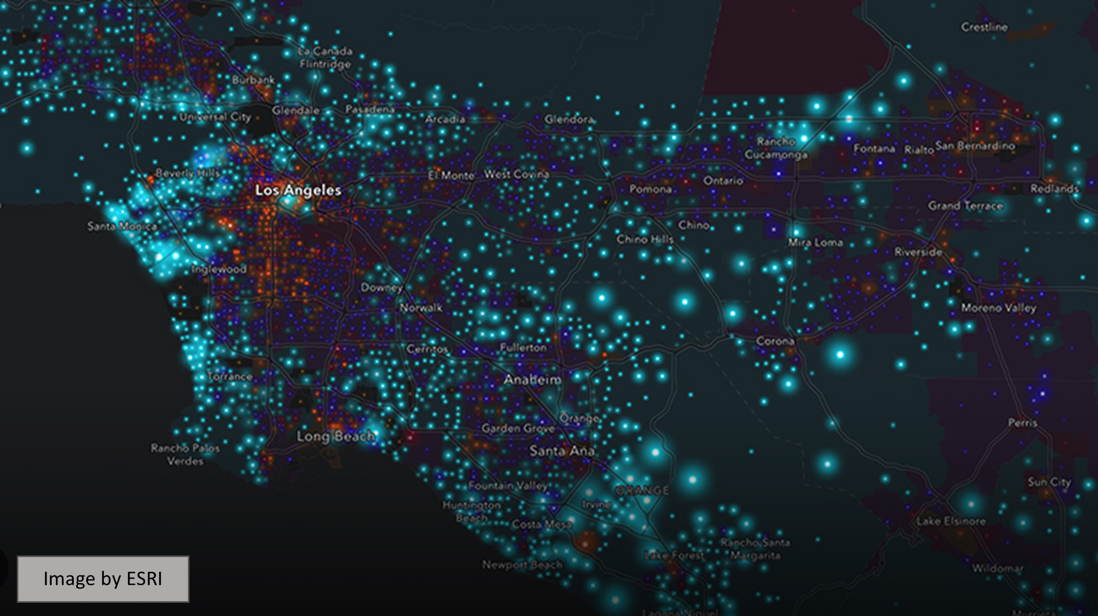
Visualizing Historical Wildfire Information in a Story Map
The 2017 wildfire season shattered records and cost the U.S. Forest Service an unprecedented $2 billion. From the Oregon wildfires to late season fires in Montana, and the highly unusual timing of the California fires in December, it was a busy year in the Western...
List of 50+ Federal GIS Servers with Open Data
Today’s post comes to us from Joseph Elfelt from MappingSupport.com. As a software developer in the field of online maps I am aware that the federal government operates various GIS servers with open data. Anyone with the right tech savvy can access that data. No...