Create an Awesome Layout with the Blank Grid Template in Experience Builder
Learn more about our Experience Builder courses and upcoming training schedule. In all our years building applications with Experience Builder, we have found that the Layout widget options have been lacking. Aside from the Sidebar widget, which is a fantastic addition...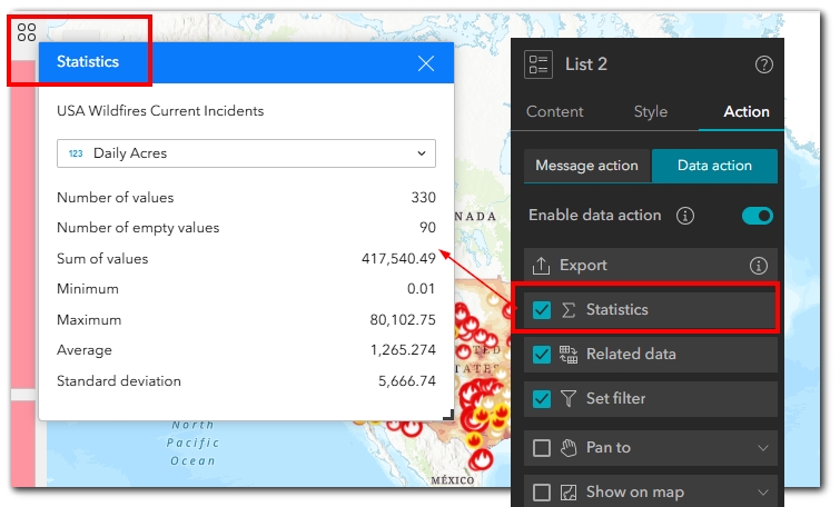
Holy Globe, Batman! Experience Builder just got even more amazing.
Learn more about our Experience Builder courses and upcoming training schedule. As usual, my finger became exhausted when scrolling through ESRI’s “What’s New in Experience Builder” page. Not that I’m complaining about the lengthy list of...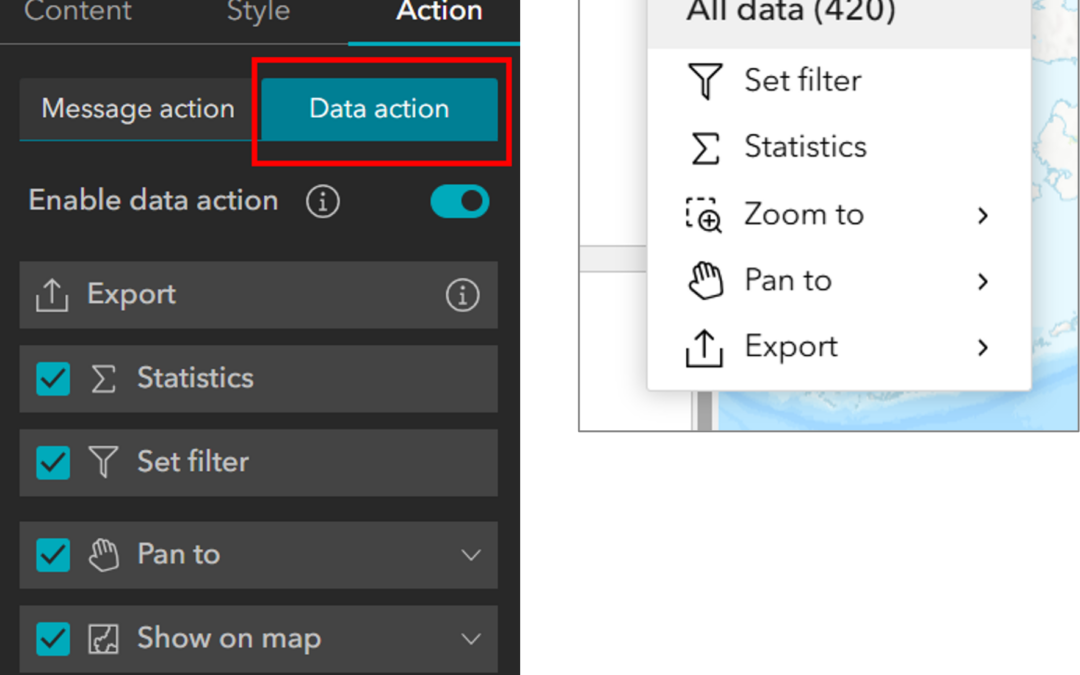
Configuring Data Actions in Experience Builder
Configuring actions in Experience Builder is part of what makes this new platform so sparkly and exciting. The actions that can be configured can range from complex to simple, depending on your needs and the needs of your target audience. There are two types of...