Automating Census Map Production with R
Many of our readers regularly work with U.S. Census data for mapping and analysis purposes. Whether you work with these datasets every day or just every now and then to create a simple map you’ve no doubt discovered how difficult it can be to decipher census...
Video: What’s New in ArcGIS Pro 2.6
ArcGIS Pro 2.6 is now available to users. This new version contains many improvements which we have been asking for for a long time. This video covers many of those improvements we think will have the most impact on current users. Hope you enjoy...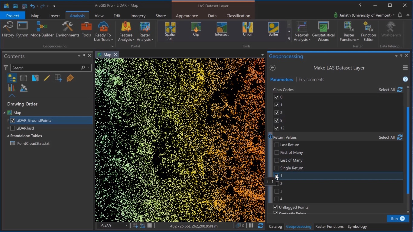
Generating Digital Surface Models from Lidar Data in ArcGIS Pro
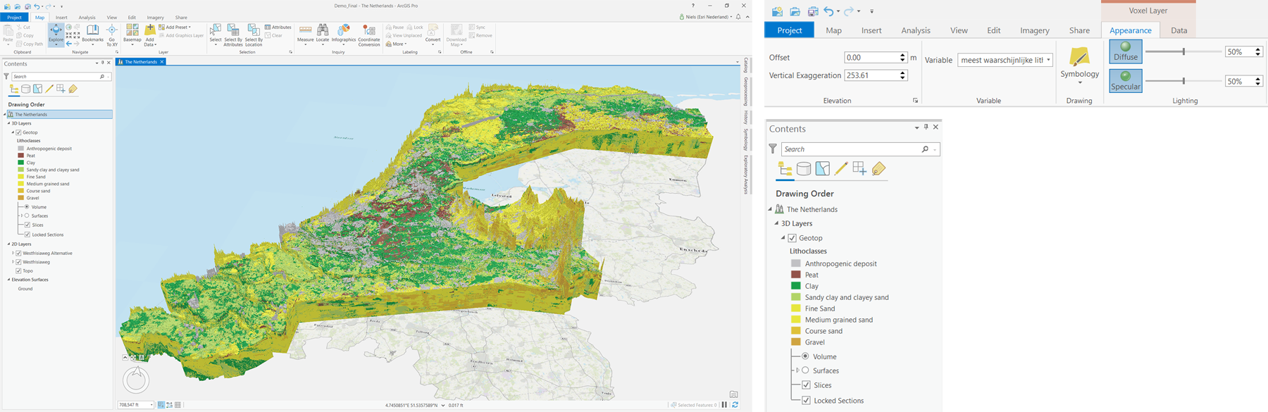
ArcGIS Pro enables the creation of raster surface models (Digital Elevation Models and derivatives such as a Digital Surface Model) from lidar point cloud data. Digital Elevation Models and derivatives such as Digital Surface Models and Digital Terrain Models are...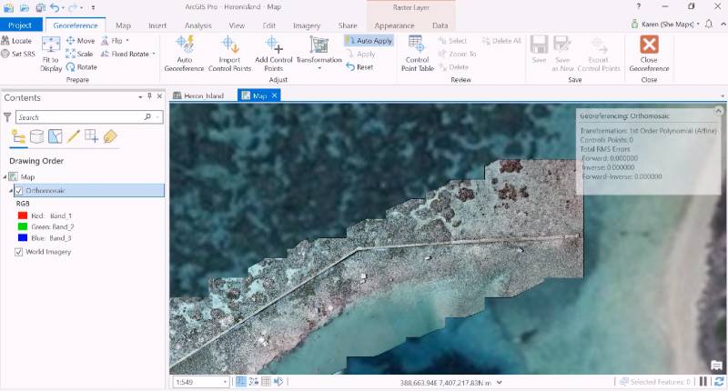
Georeferencing Drone Data in ArcGIS Pro using Ground Control Points
ArcGIS Pro enables the creation of Ground Control Points as a way to georeference drone data to satellite base map data, so that user-generated imagery data is placed on the correct spatial location and fit for further use inside a GIS. When bringing in a new drone...