
How to Add Data Science to your GIS Skills
GIS professionals interested in data science can start their journey into this field by exploring various spatial data analysist tools offered by ArcGIS and learning how to code. Current GIS software offers many tools that fall into the data science category. As such,...
Glassdoor Ranks Data Scientist #1 Job in America
Glassdoor, one of the fastest growing job and recruiting sites, recently rated Data Scientist as the #1 job in America based on number of job openings, salary, and overall job satisfaction. Geospatial Training Services offers a number of classes to help you get up to...
R Tutorials for Spatial Analysis
R has a full library of tools for working with spatial data. This includes tools for both vector and raster data, as well as interfacing with data from other sources (like ArcGIS) and making maps. Here are some excellent resources for learning R and R for Spatial...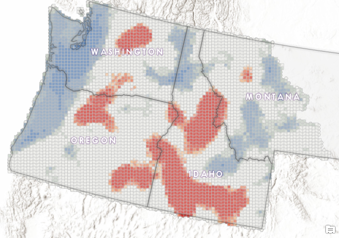
What Can Spatial Analytics Tell Us About 30 Years of Large Wildfires in the Pacific Northwest?
Studies suggest that over the past few decades, the number and size of wildfires have increased throughout the western United States. The average length of wildfire season has increased significantly as well. According to the Union of Concerned Scientists...