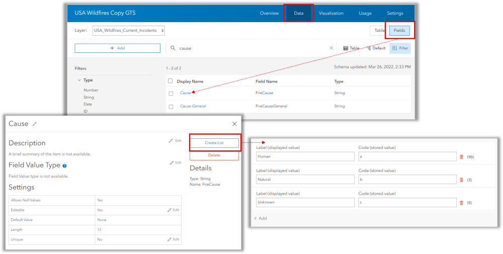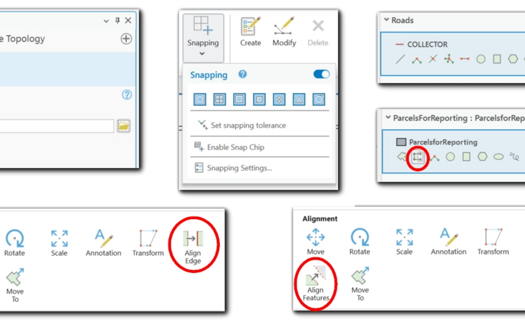
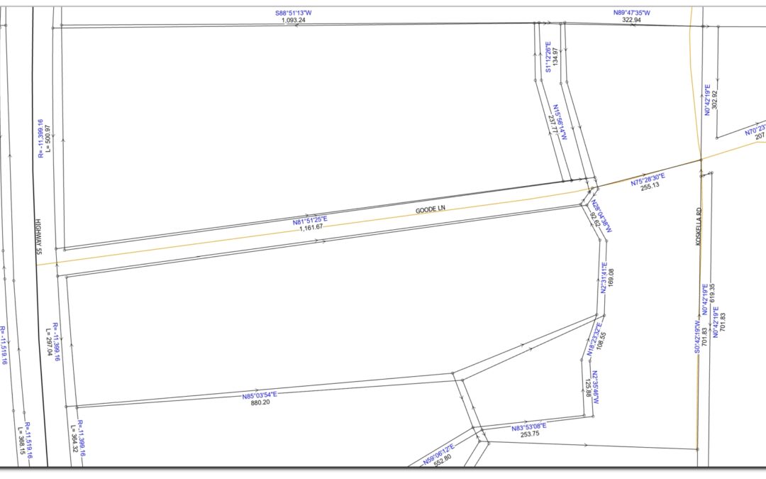
COGO vs. Parcel Fabric: Defining Boundaries with Precision and Structure
In cadastral GIS, the accuracy and integrity of parcel boundaries are crucial for land management, taxation, and development. Two core concepts, COGO (Coordinate Geometry) and Parcel Fabric, help GIS professionals ensure that parcel data is both precisely measured and...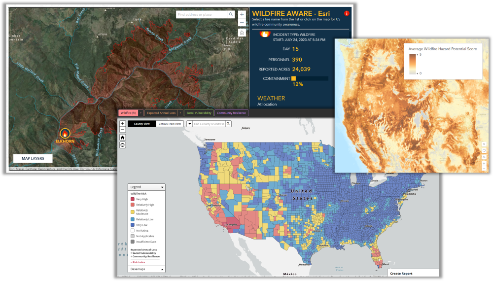
Understanding your Wildland Fire Risk
GIS resources to help you explore, analyze, and understand your risk. Wildland Fires are becoming more frequent with higher destruction rates relative to land and property. Many of the most destructive fires in terms of financial loss have occurred since 2017. Here...