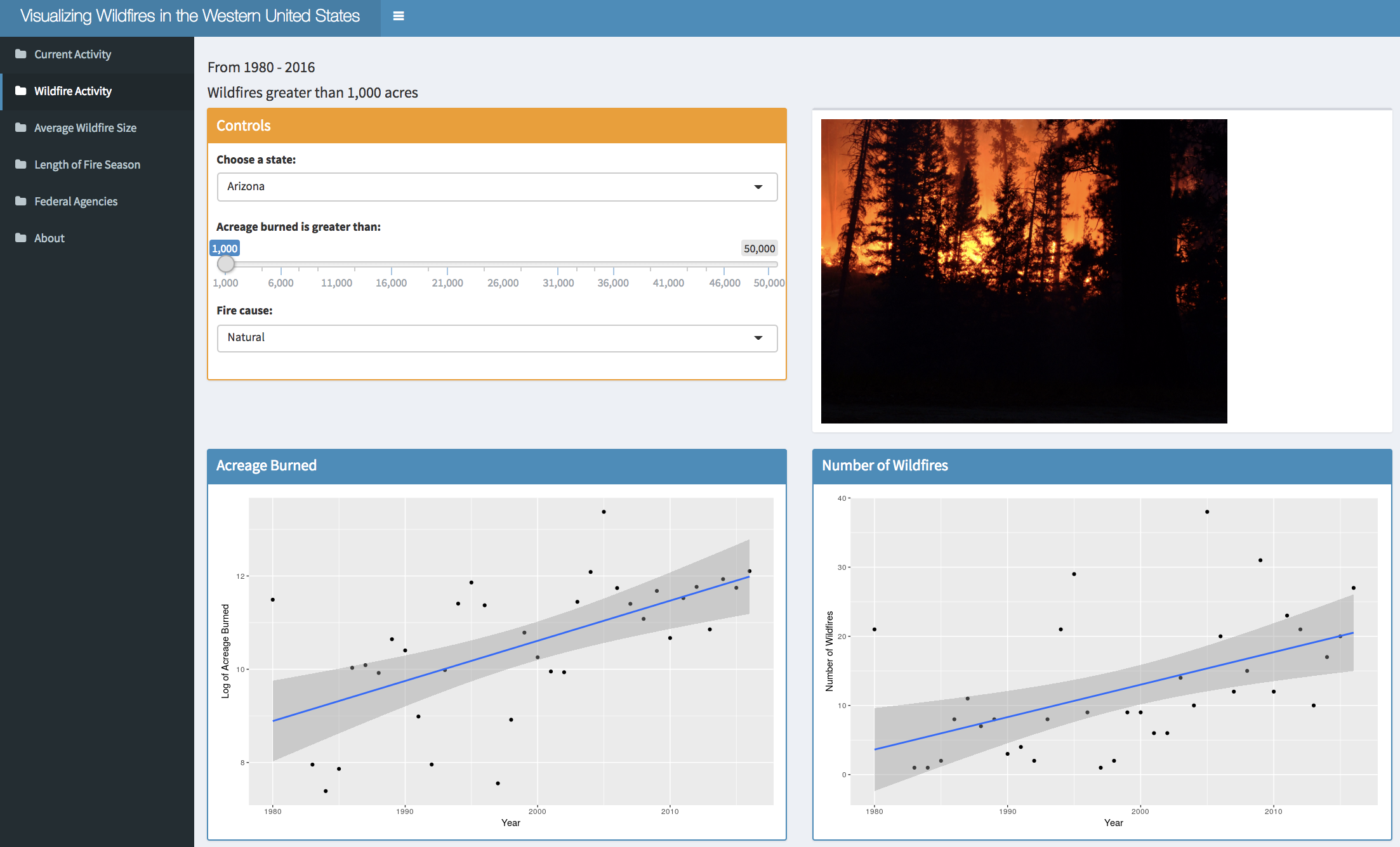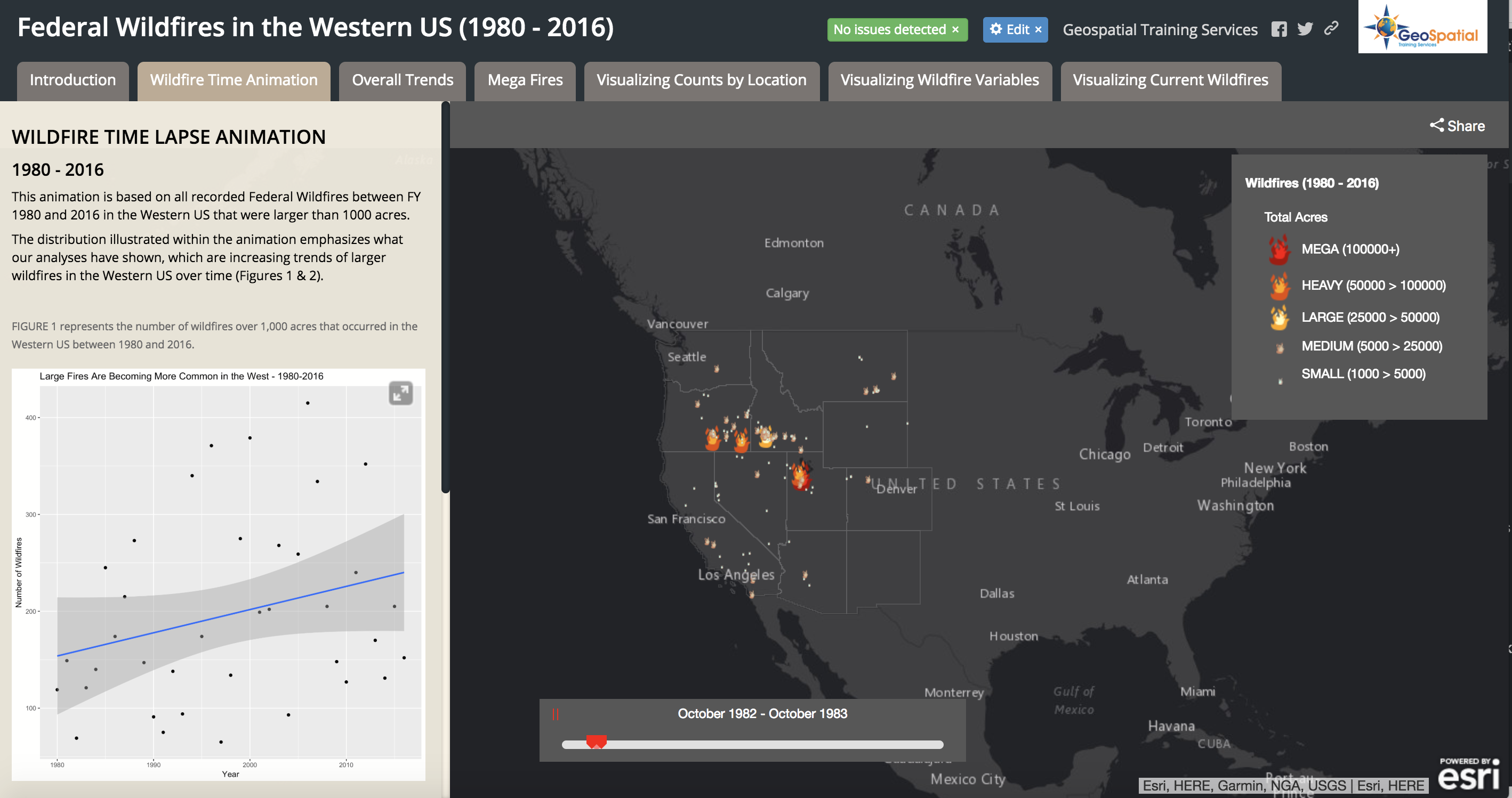
Visualizing Historical Wildfire Information in a Story Map
The 2017 wildfire season shattered records and cost the U.S. Forest Service an unprecedented $2 billion. From the Oregon wildfires to late season fires in Montana, and the highly unusual timing of the California fires in December, it was a busy year in the Western...
ArcGIS Pro 2.2 Released – Lots of New Features
ArcGIS Pro 2.2 is a major release full of exciting new features. If you haven’t already begun migrating from ArcGIS Desktop to ArcGIS Pro now is certainly a great time to get started. ArcGIS Pro 2.2 is Esri’s 64-bit flagship desktop product. Here are...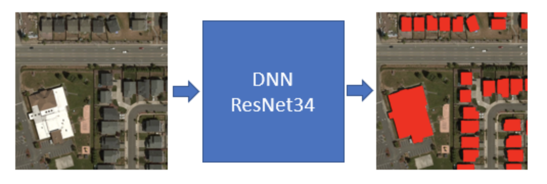
Microsoft Generates 125 million Building Footprints using AI and Deep Learning
Microsoft has announced the availability of approximately 125 million building footprint polygon geometries in all 50 US States in an open source GeoJSON format. Using a two step process centered around the use of artificial intelligence (AI), deep learning, and...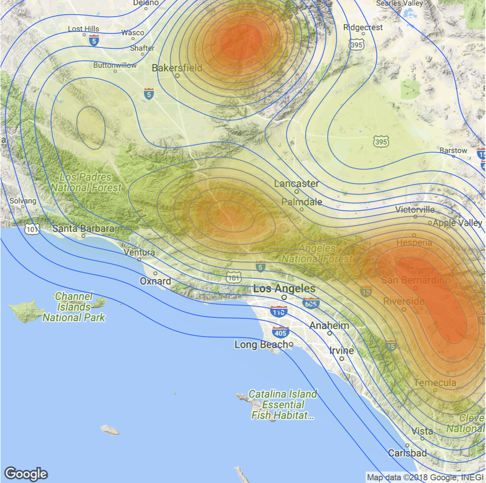
Spatial Visualization with R and ggmap
The ggmap package enables the visualization of spatial data and spatial statistics in a map format using the layered approach of ggplot2. This package also includes basemaps that give your visualizations context including Google Maps, Open Street Map, Stamen Maps, and...