New Startup Options for ArcGIS Pro 2.3
In versions of ArcGIS Pro prior to version 2.3 a project was required anytime the software was used. This would require that you either open an existing project that was created in the past or the creation of an entirely new project. End users have been dissatisfied...
1400+ Addresses for Government ArcGIS Servers
Joseph Elfelt of MappingSupport.com has posted a new PDF file containing URLs for local, state, and federal ArcGIS Servers with open data. Here is the updated list: https://mappingsupport.com/p/surf_gis/list-federal-state-county-city-GIS-servers.pdf The primary...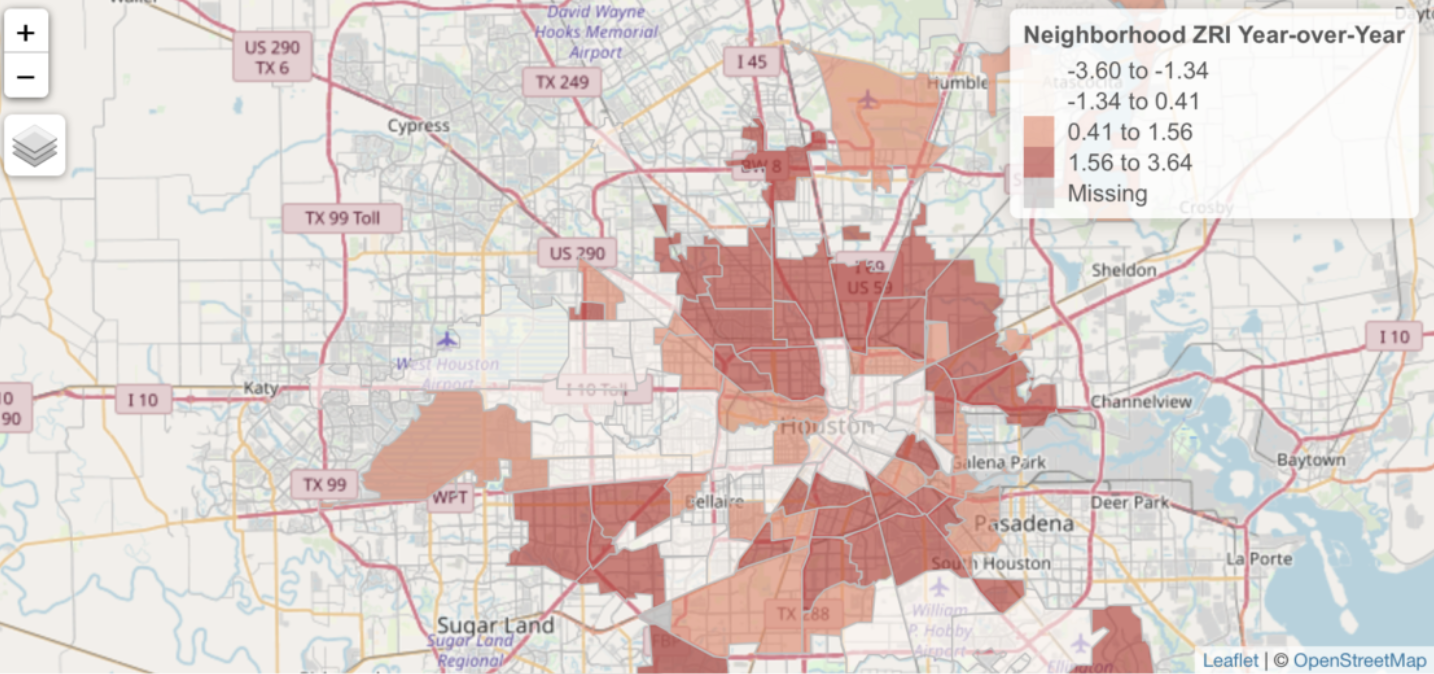
Zillow Local Market Rental Overview Application
Head over to our sister site – Location3x – and check out a sample application that we built with Shiny and R. The Zillow Market Overview: Rentals application is a dynamic web application that illustrates the visualization capabilities provided by the...
Editing Data in ArcGIS Pro – Using basic distance and direction tools to create line segments
This video demonstrates how to create simple line segments at specific distances and directions while editing data in ArcGIS Pro. Upcoming ArcGIS Pro Classes Learning ArcGIS Pro 1: Maps and Projects Learning ArcGIS Pro 2: Editing, Analysis, and Automation Learning...