ArcGIS Pro 2.3 Released – What’s New?
Esri just released an update for ArcGIS Pro. This new version, 2.3, contains a wealth of improvements, I think you will like. Just to mention a few: Now you can open a new blank project without a template. This means all those project files that normally are created...
GISP Certification Experience Points
Continuing our GISP Certification series, this video discusses how to fill out the experience portion of the GISP portfolio and calculate your points. If you are not familiar with the GISP Certification process, we recommend you watch our previous video in this series...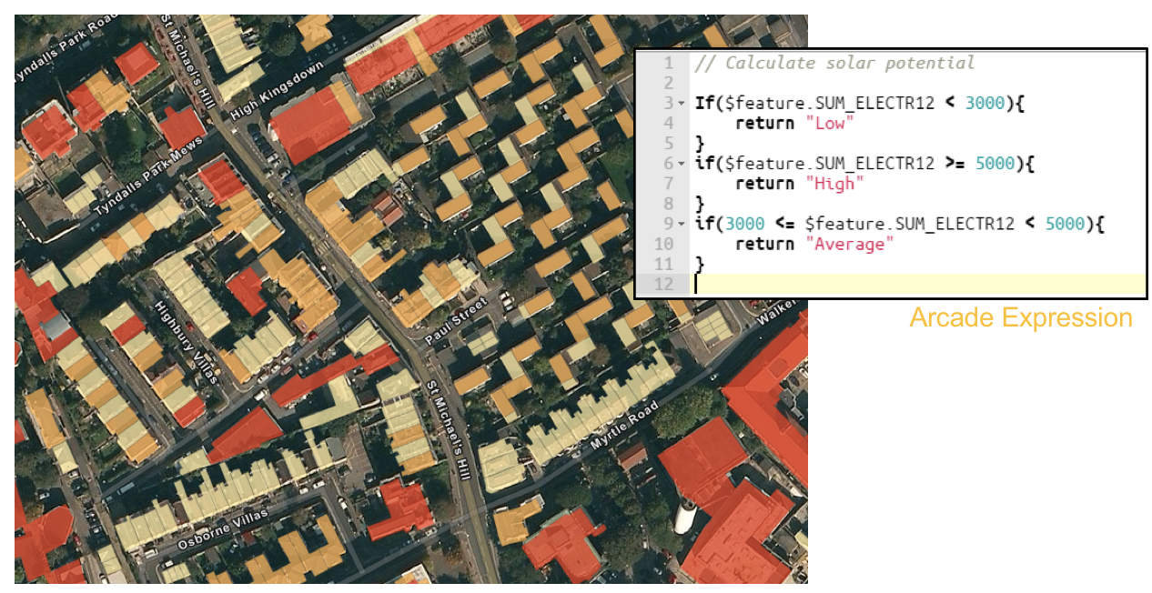
ArcGIS Arcade – The GIS Language You Probably Haven’t Learned but Definitely Should
While the ArcGIS Arcade language has been around for awhile now most GIS professionals haven’t yet taken the time to examine how this simple expression language can be used to dynamically produce content and visualization for both ArcGIS Pro and ArcGIS Online. ...
ArcGIS Pro Tip: Using Project Favorites
ArcGIS Pro introduced the usage of project files, which allow you to assemble all the resources required to complete a project in one place. A project, stored in a file with an extension of .aprx, can contain maps, layouts, tasks, and connections to servers,...