Tutorial – Creating a Heat Map in ArcGIS Pro
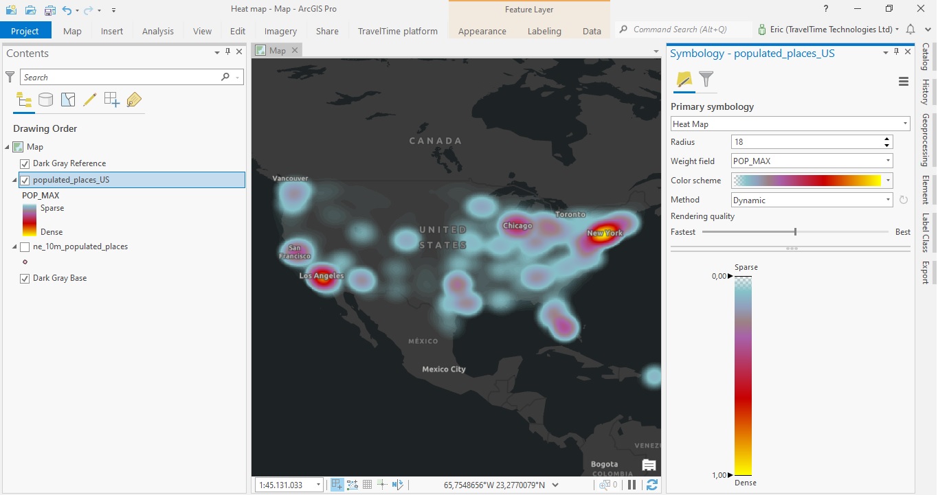
In this tutorial, you will learn how to create a heat map in ArcGIS Pro. This heat map will display the distribution of individual points that represent populated areas in the US. Using population values as a weight field, we can visualize the highest populated areas...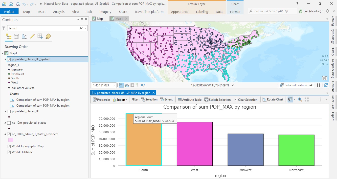
Combining Multiple Spatial Analysis tools in ArcGIS Pro
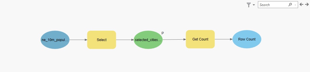
The following tutorial uses multiple spatial analysis tools to be able to compare population counts for the four different regions in the US. When doing spatial analysis, you often must combine multiple tools to be able to find a solution to a specific problem. This...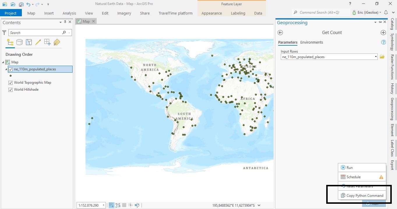
ArcGIS Pro 2.8’s New Copy Python Command
ArcGIS Pro 2.8 comes with a new handy feature that copies the Python command when running a geoprocessing tool inside Pro. This tutorial shows how the tool works, describes some best use cases and how the interpret the results. Pro 2.8 introduces a new handy feature...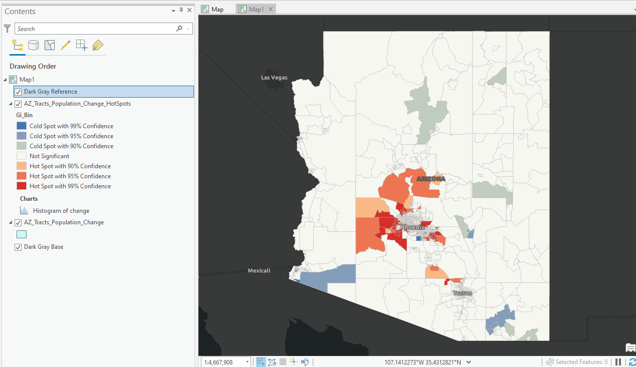
Mapping Population Growth Hot Spots with R and ArcGIS Pro
This tutorial demonstrates how to use R and ArcGIS Pro to generate hot spot maps of population growth by census tract. In a previous article I showed you how to use the tidycensus R package to quickly access and map US census data. You can also download a free copy of...