
Tutorial: Using Pairwise Buffering, Dissolve and Clip Tools
This tutorial shows how to speed up your GIS workflow with three tools that use parallel processing. These tools are recommended for use when you have many features to be processed at once. GIS analysis often involves the use of buffering, dissolve and clip tools....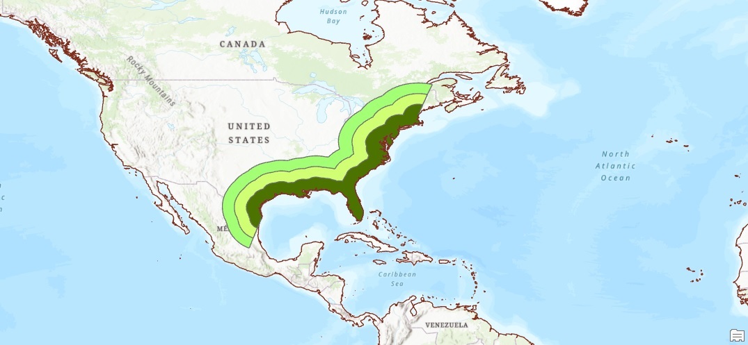
Tutorial: Using Pro’s Buffer Tools Inside Polygons and Polylines
In this tutorial, we’ll show how to use negative buffer values to accentuate the edges of a polygon. Next, we’ll show how you can create a buffer on one side of a polyline, for example to calculate the distance from a coastline land inward. ArcGIS Pro offers multiple...
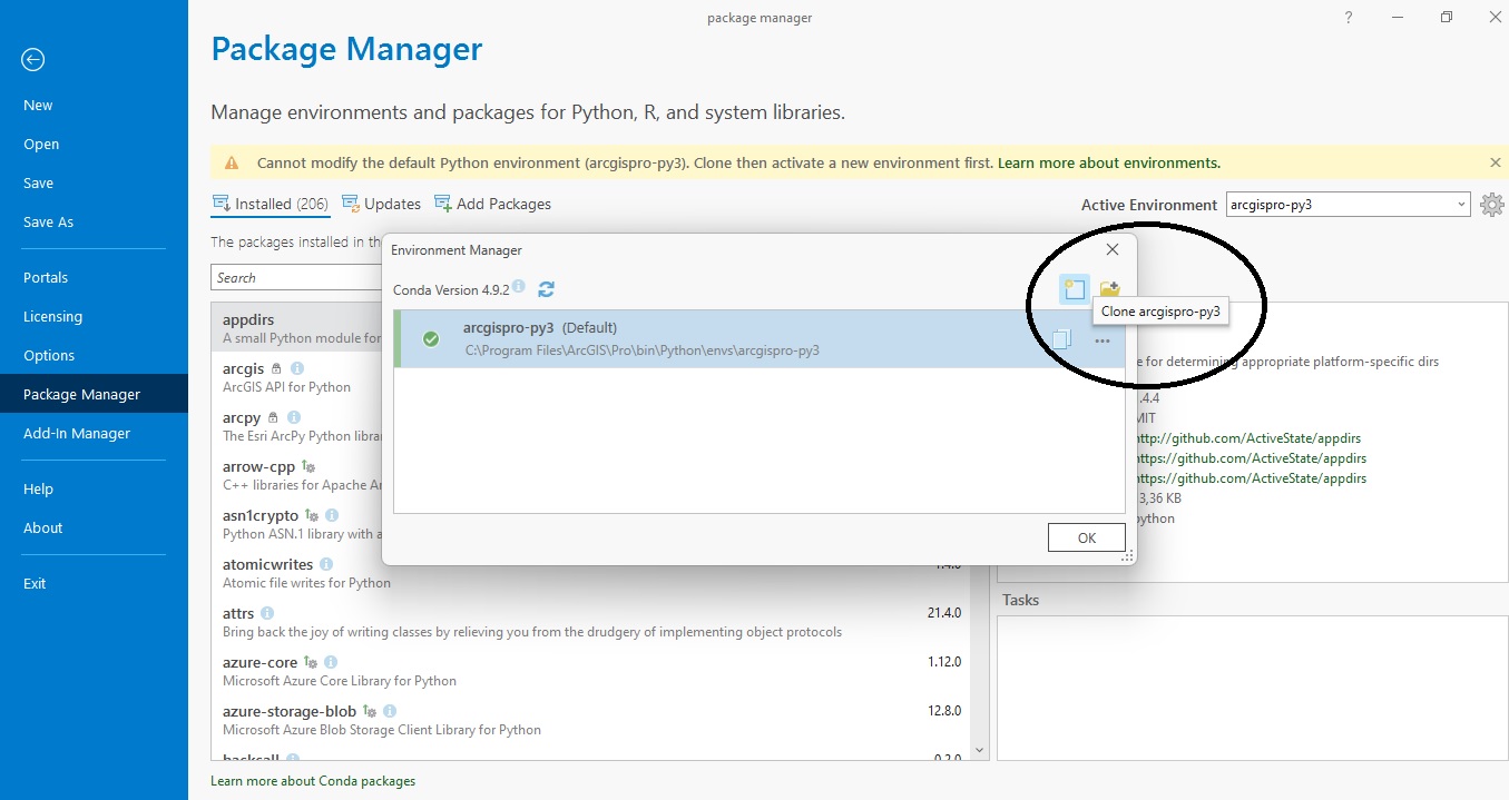
What’s New in ArcGIS Pro 3
Esri has just released a major version of ArcGIS Pro. We’ll have a look at some important new features below. Version 3.0, released in June 2022, is a major update of Pro, which means new functionality, a new design and more. Here are some of the highlights of the new...