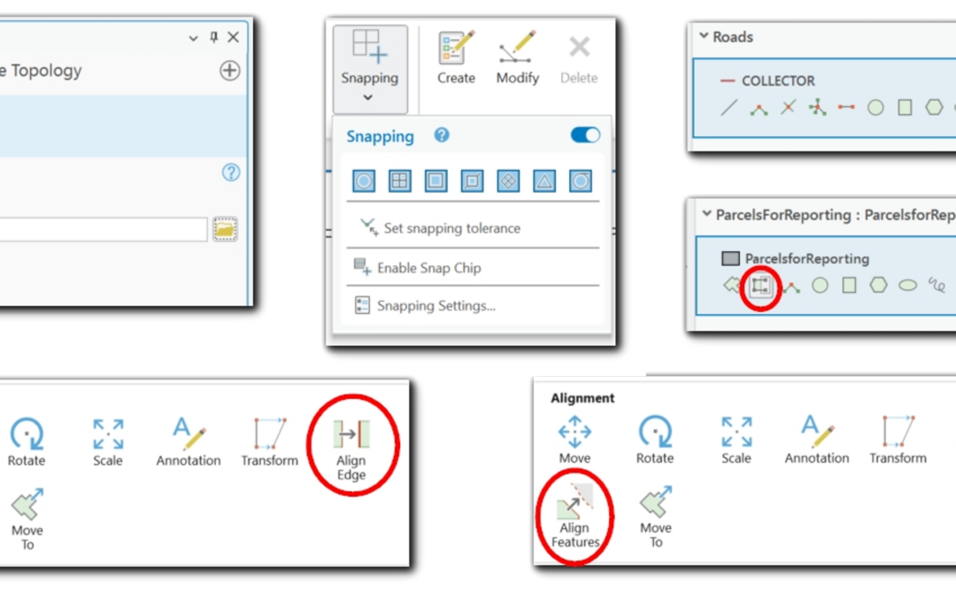
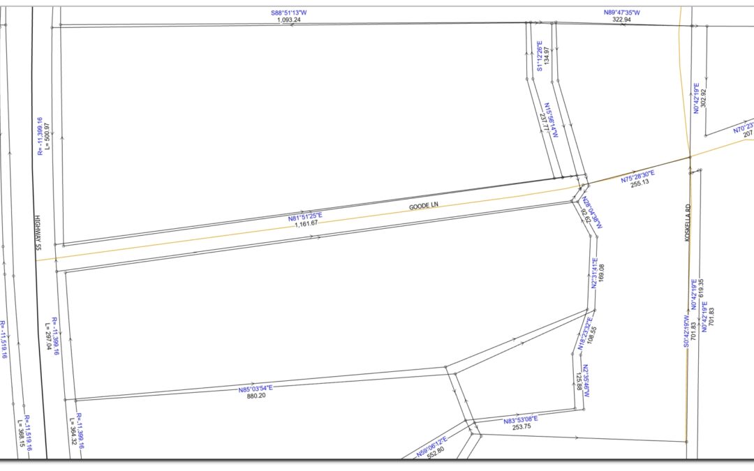
COGO vs. Parcel Fabric: Defining Boundaries with Precision and Structure
In cadastral GIS, the accuracy and integrity of parcel boundaries are crucial for land management, taxation, and development. Two core concepts, COGO (Coordinate Geometry) and Parcel Fabric, help GIS professionals ensure that parcel data is both precisely measured and...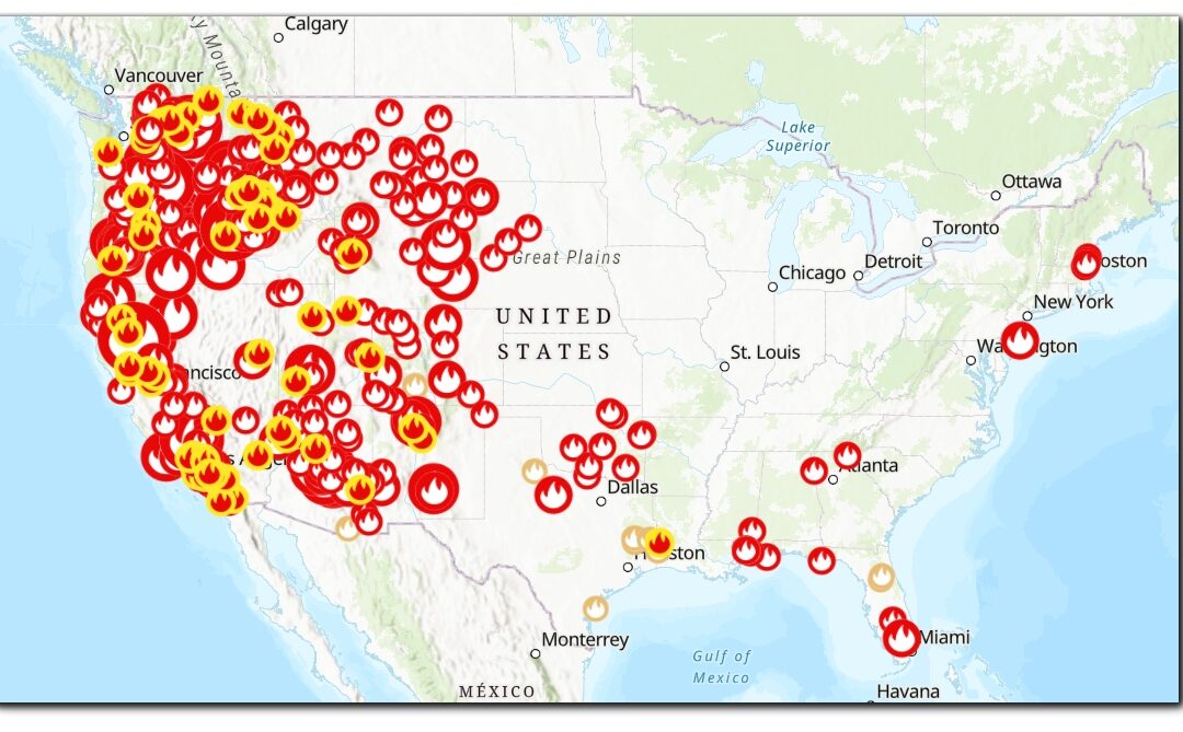
How to stream live Wildfire Data in your maps in ArcGIS Pro
Statistics show that wildland fires are igniting more frequently and causing more damage with each passing year. From the forest-surrounded communities of the western landscape and rural grasslands of the Midwest to the eastern states and wild areas of our National...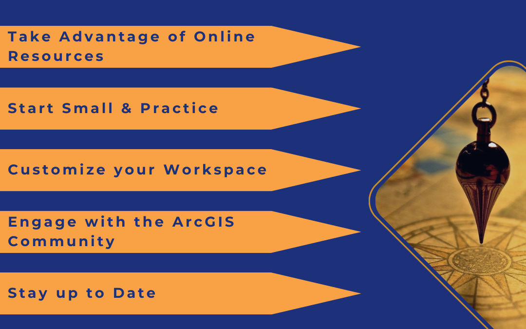
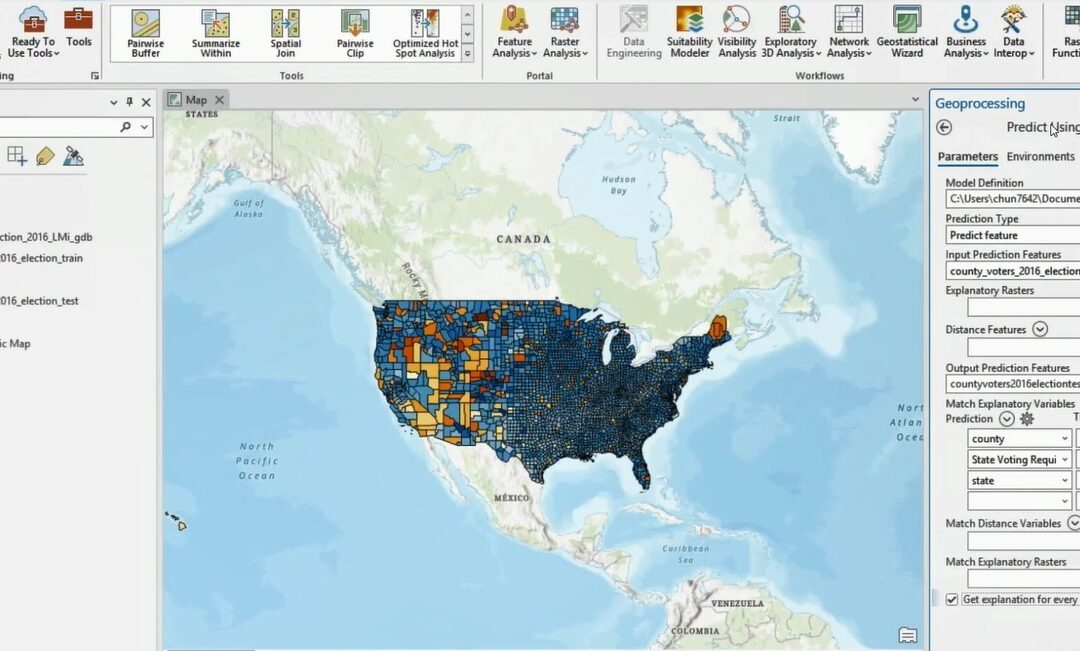
How to Master ArcGIS Pro and Experience Builder
The retirement of ArcMap and Web AppBuilder is here and, unfortunately, can’t be ignored. Yet, many GIS users are still struggling to take the first steps toward learning ArcGIS Pro and Experience Builder. This is not uncommon and is understandable. Because we...