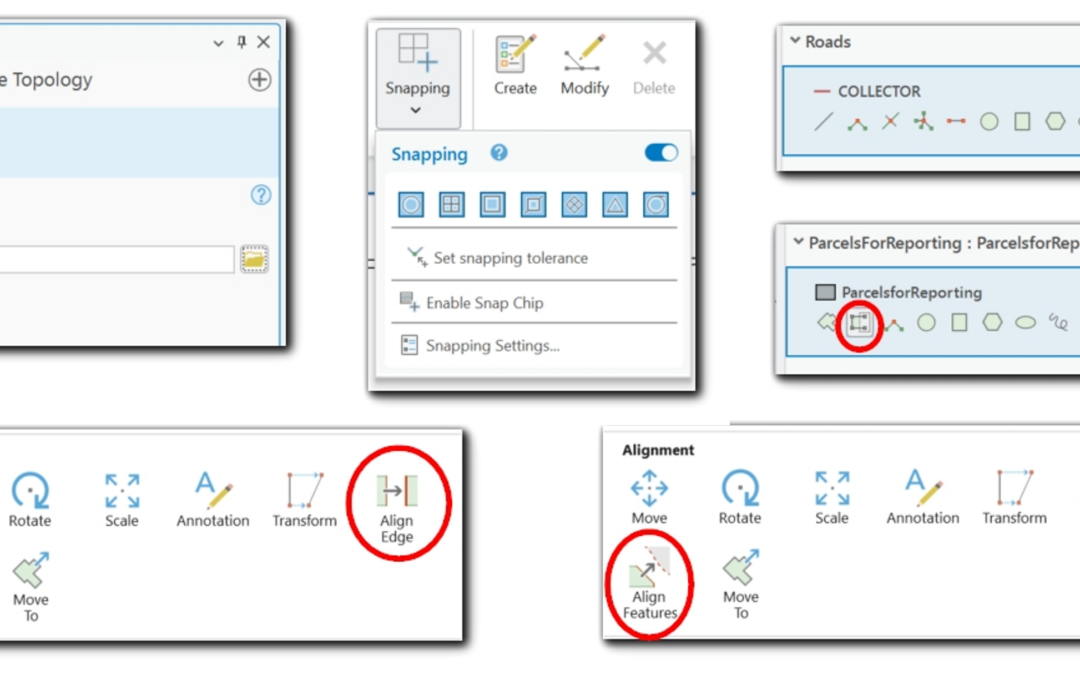
Tips and Tricks for Creating Adjacent Polygons Without Gaps or Overlaps in ArcGIS Pro
Save 20% on our GIS training through May 31st by using the discount code springsale when checking out. Why Topological Accuracy Matters In GIS, adjacent polygons must meet seamlessly to support reliable spatial analysis. Gaps or overlaps between features can lead to...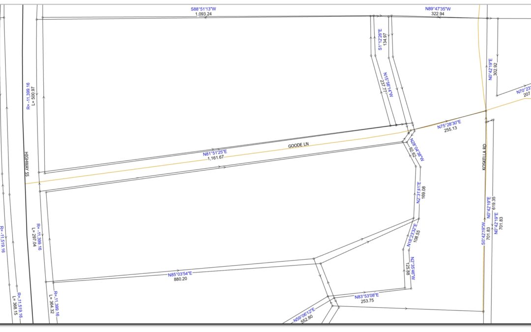
COGO vs. Parcel Fabric: Defining Boundaries with Precision and Structure
In cadastral GIS, the accuracy and integrity of parcel boundaries are crucial for land management, taxation, and development. Two core concepts, COGO (Coordinate Geometry) and Parcel Fabric, help GIS professionals ensure that parcel data is both precisely measured and...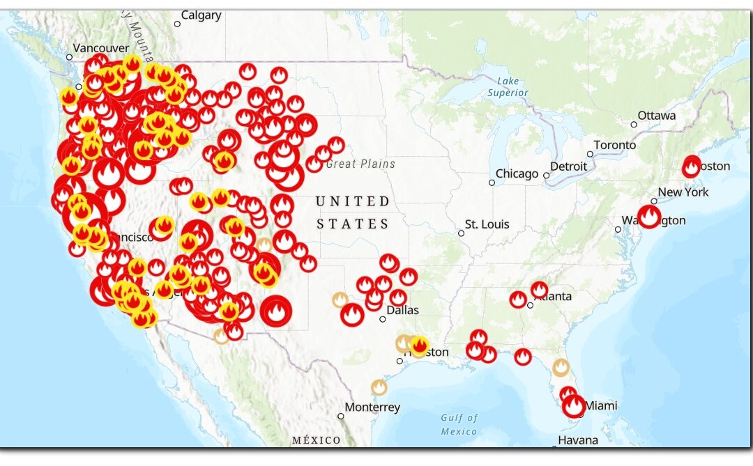
How to stream live Wildfire Data in your maps in ArcGIS Pro
Statistics show that wildland fires are igniting more frequently and causing more damage with each passing year. From the forest-surrounded communities of the western landscape and rural grasslands of the Midwest to the eastern states and wild areas of our National...