How to Add Data Science to your GIS Skills
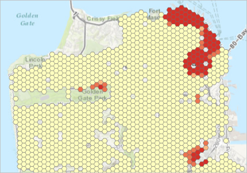
GIS professionals interested in data science can start their journey into this field by exploring various spatial data analysist tools offered by ArcGIS and learning how to code. Current GIS software offers many tools that fall into the data science category. As such,...
Why the Future Looks Bright for Data Scientists
A recent study from job site Glassdoor showed that data scientist is currently the best job to apply for, offering a median base salary of $110,000 and job satisfaction of 4.4 out of 5. Let´s have a look at the different types of data scientists and the required...
Glassdoor Ranks Data Scientist #1 Job in America
Glassdoor, one of the fastest growing job and recruiting sites, recently rated Data Scientist as the #1 job in America based on number of job openings, salary, and overall job satisfaction. Geospatial Training Services offers a number of classes to help you get up to...
R Tutorials for Spatial Analysis
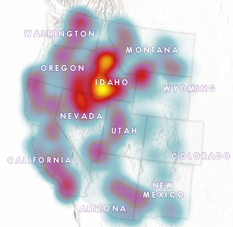
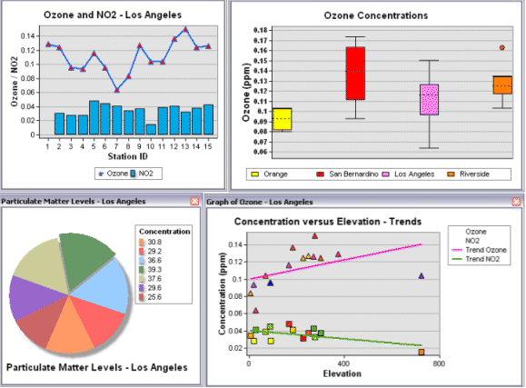
R has a full library of tools for working with spatial data. This includes tools for both vector and raster data, as well as interfacing with data from other sources (like ArcGIS) and making maps. Here are some excellent resources for learning R and R for Spatial...