• Follow
  • Follow
  • Follow
  • GIS Training
  • Articles
  • Videos
  • Books
  • Consulting Services
  • About
  • Training Login
  • GIS Training
  • Articles
  • Videos
  • Books
  • Consulting Services
  • About
  • Training Login
Displaying LiDAR Data in ArcGIS Desktop

Displaying LiDAR Data in ArcGIS Desktop

by Eric van Rees | Aug 29, 2016 | ArcGIS Desktop, Free Articles & Tutorials, Lidar

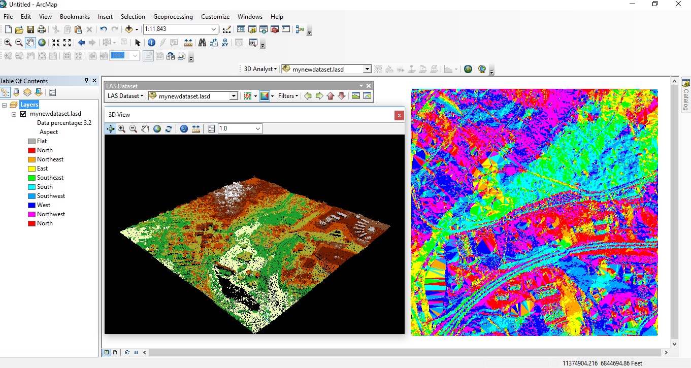
Since the release of version 10.1, ArcGIS Desktop offers native support for LAS files, the industry-standard binary file format for storing airborne LiDAR data. Introduced in version 10.2.2 of ArcGIS Desktop, the LAS Dataset file is a new file format for storing...

Categories

Recent Posts

  • Understanding GIS Data Formats in ArcGIS Pro: A Comprehensive GuideMay 7, 2025
  • Tips and Tricks for Creating Adjacent Polygons Without Gaps or Overlaps in ArcGIS ProApril 28, 2025
  • COGO vs. Parcel Fabric: Defining Boundaries with Precision and StructureApril 28, 2025
  • Mastering Selection Layers in ArcGIS Pro: A Powerful Tool for GIS AnalysisApril 23, 2025
  • Elevate Your GIS Skills This Spring – 20% Off All Training CoursesApril 11, 2025


215 W Bandera Suite 114-104, Boerne, TX



1-210-260-4992



sales@geospatialtraining.com

  • Follow
  • Follow
  • Follow
Copyright © 2025 Geospatial Training Services | Designed by Micael McKenzie Inc Creative


In Person Classes

Check our schedule for classes near you.



Live Online Classes

Provided through our online training platform.



All Events

Browse all upcoming courses.



Self-Paced

Classes at your own pace, in your own time.



Group Training

Custom GIS Training for groups.



Training Bundles

Self-paced, flexible training bundles.



Annual GIS Training License

24/7 Access to all our self-paced online courses.



Course Catalog

View full list of courses by topic of interest



Learning Pathways

Not sure which ArcGIS Pro class to take first?

Sign up for our weekly newsletter
to receive content like this in your email box.

×