
ArcGIS Pro Tip – Geoprocessing Pane: To Auto-Hide or Not?
ArcGIS Pro is Esri’s latest Desktop GIS Application. It will be replacing ArcMap and ArcCatalog at some point (We have heard anywhere between 2 to 7 years). ArcGIS Pro is still very much a work in progress but it has come a long way since first released in 2015....
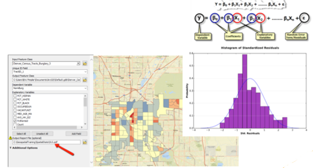
Analyzing Wildfire Activity with Spatial Analytics – Part 1
Today’s post will be the first in a series designed to introduce the reader to a typical spatial analytics project using the Spatial Statistics toolbox in ArcGIS along with the R and Python programming languages. We’re going to apply various spatial...
Annual Sale on GIS Training – Save up to 25%
It’s time again for our annual anniversary sale. This month marks our 12th year in business and to celebrate we’re discounting all our training courses including the Annual GIS Training License. As usual, the earlier you register, the more you save. To take...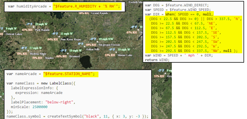
New Class – Getting Started with ArcGIS Arcade
Geospatial Training Services is releasing a new Getting Started with ArcGIS Arcade on Friday, April 28th. Arcade is a response to a common problem. How do you display data when there is no column in the schema containing that data? Up until now, if the map layer you...