

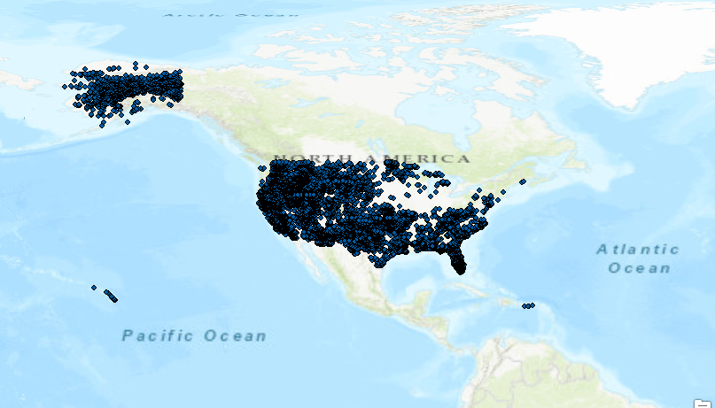
Tutorial: Creating a Pandas DataFrame from a Shapefile
ArcPy doesn´t have an option to export shapefile attribute tables to pandas DataFrame objects. Fortunately, there are number of workarounds available to make this happen. Pandas DataFrame objects are comparable to Excel spreadsheet or a relational database table. They...
Giving Away 5 Copies of Programming ArcGIS Pro with Python
We’re giving away another 5 copies of the digital version of my book Programming ArcGIS Pro with Python the last day of December. Yesterday we gave away the first 5 copies and we’ll do this every month for six months. Register at the link below....
Save 25% on GIS Training – 14th Annual Holiday Sale
Our 14th annual holiday sale begins this Monday, November 20th. You can save up to 25% on any GIS training that we provide including our Annual GIS Training License and any of our live training events below. Simply use the discount code ‘holiday’ when...
Getting to know GeoPandas
This blog post covers GeoPandas, a Python package that makes working with geospatial data easier. What is GeoPandas? GeoPandas is an open source project for working with geospatial data in Python. It is designed to work with existing tools, such as desktop GIS,...