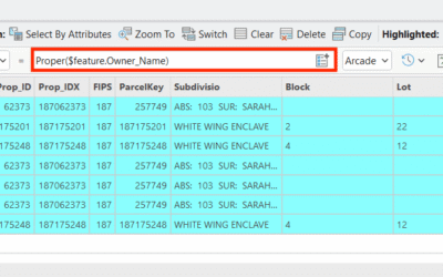
Learn more about this ArcGIS Pro topic and others in our Mastering ArcGIS Pro 3: Maps, Layers, Projects, and Layouts class and our Mastering ArcGIS Pro 3: Editing, Analysis, and Automation class. If you've spent any time making thematic maps in ArcGIS Pro, you've...
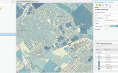
Mastering the Graduated Color Renderer in ArcGIS Pro: A Guide to Classification Methods
read more