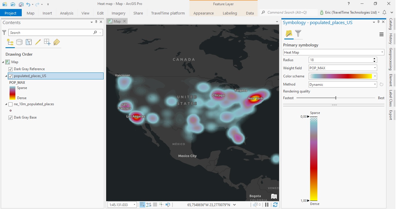
In this tutorial, you will learn how to create a heat map in ArcGIS Pro. This heat map will display the distribution of individual points that represent populated areas in the US. Using population values as a weight field, we can visualize the highest populated areas...
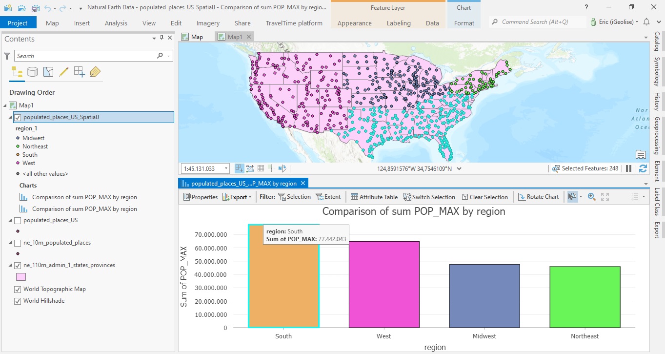
The following tutorial uses multiple spatial analysis tools to be able to compare population counts for the four different regions in the US. When doing spatial analysis, you often must combine multiple tools to be able to find a solution to a specific problem. This...
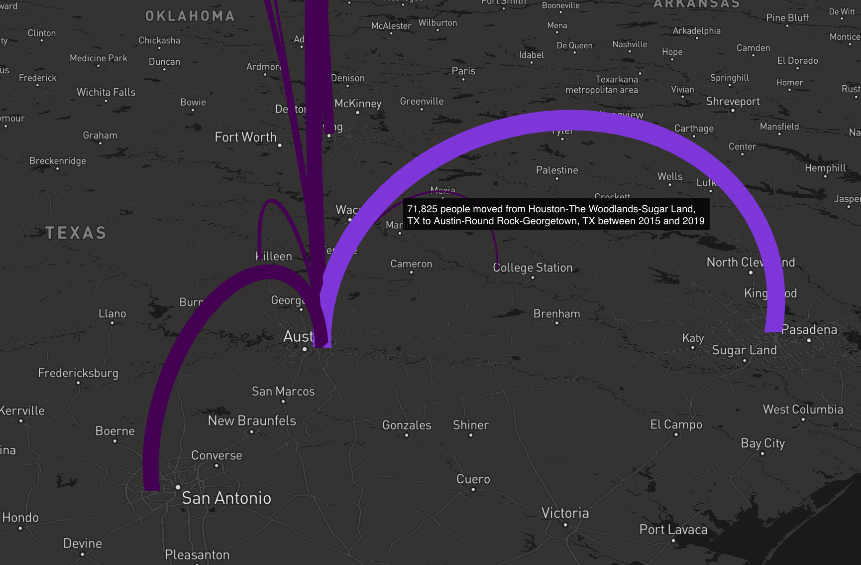
The American Community Survey Migration Flows dataset estimates the number of people that have moved between pairs of places. The estimates are calculated based on where a person lived when surveyed and where they lived one year prior to being surveyed. The data is...