Unlocking the Power of the Data Engineering Tool in ArcGIS Pro
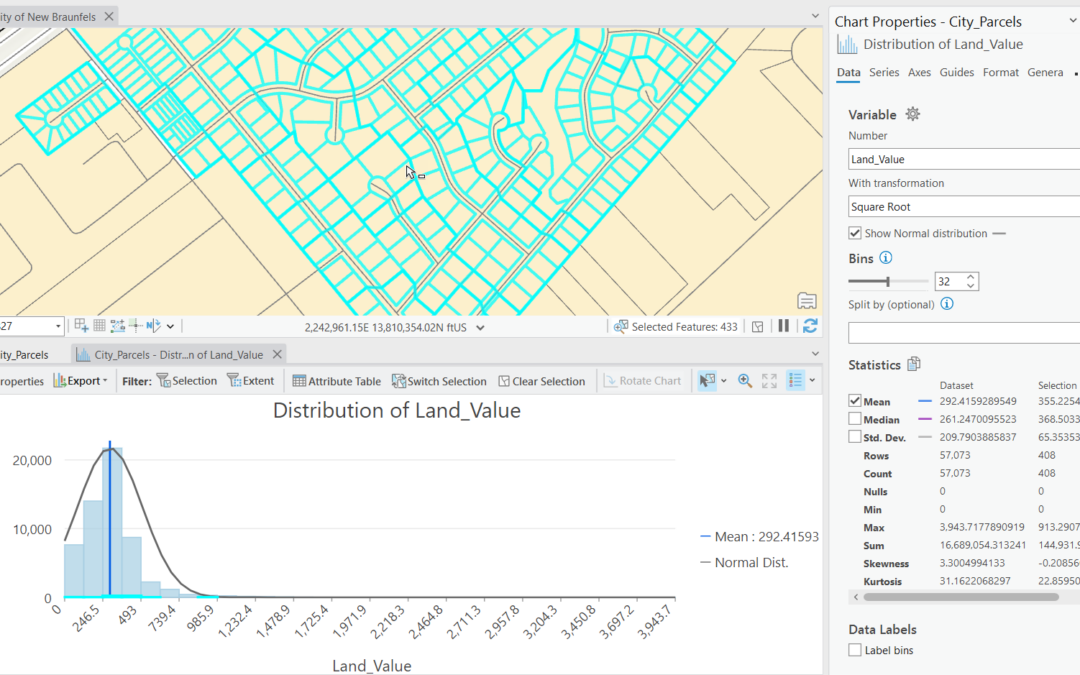
When working with geospatial data, ensuring its accuracy and readiness for analysis is crucial. This is where ArcGIS Pro’s Data Engineering tool comes into play. Designed to help GIS professionals explore, clean, and prepare their data efficiently, the Data...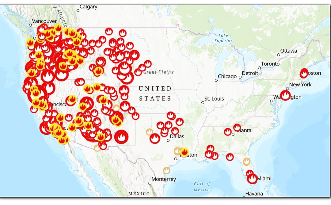
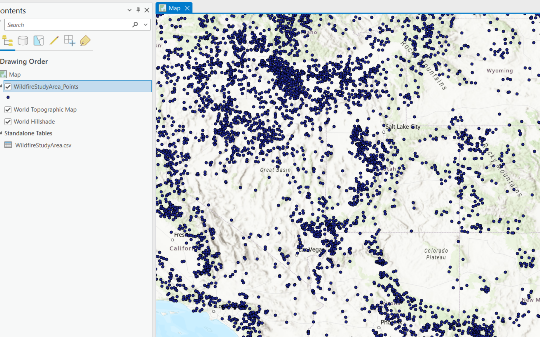
How to stream live Wildfire Data in your maps in ArcGIS Pro
Statistics show that wildland fires are igniting more frequently and causing more damage with each passing year. From the forest-surrounded communities of the western landscape and rural grasslands of the Midwest to the eastern states and wild areas of our National...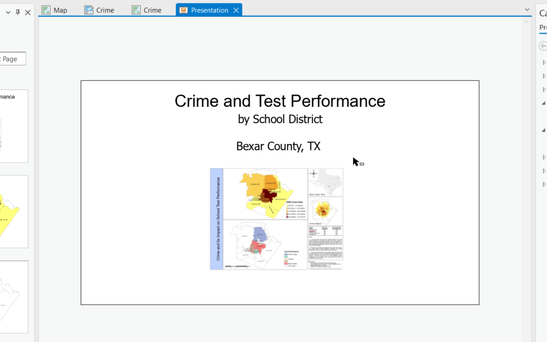
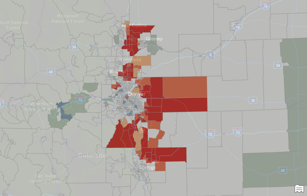
Unlock the Power of Storytelling with Presentations in ArcGIS Pro 3.3
Effective communication of data and insights is crucial to GIS professionals. ArcGIS Pro 3.3 introduces an exciting feature that revolutionizes the way we present geographic information: interactive presentations. Whether you’re a GIS professional, educator, or...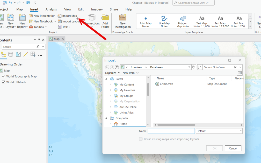
Effortlessly Import ArcMap Content into ArcGIS Pro
Transitioning from ArcMap to ArcGIS Pro marks a significant step forward in the world of GIS, bringing enhanced capabilities, a modern interface, and improved performance. However, one of the key challenges users face is effectively importing existing maps and layouts...