Data Visualization and Exploration with R
My new book, Data Visualization and Exploration with R, has been published in digital format and printed paperback versions. This book is a practical guide to using R, RStudio, and tidyverse for data visualization, exploration, and data science applications. $39.00...New Book – Data Visualization and Exploration with R
My new book, Data Visualization and Exploration with R, is scheduled for publication on September 20th, 2018. Our newest class, Introduction to R for Data Visualization (Charts, Graphs, and Maps), is also based on this book. You can pre-order a digital version of the...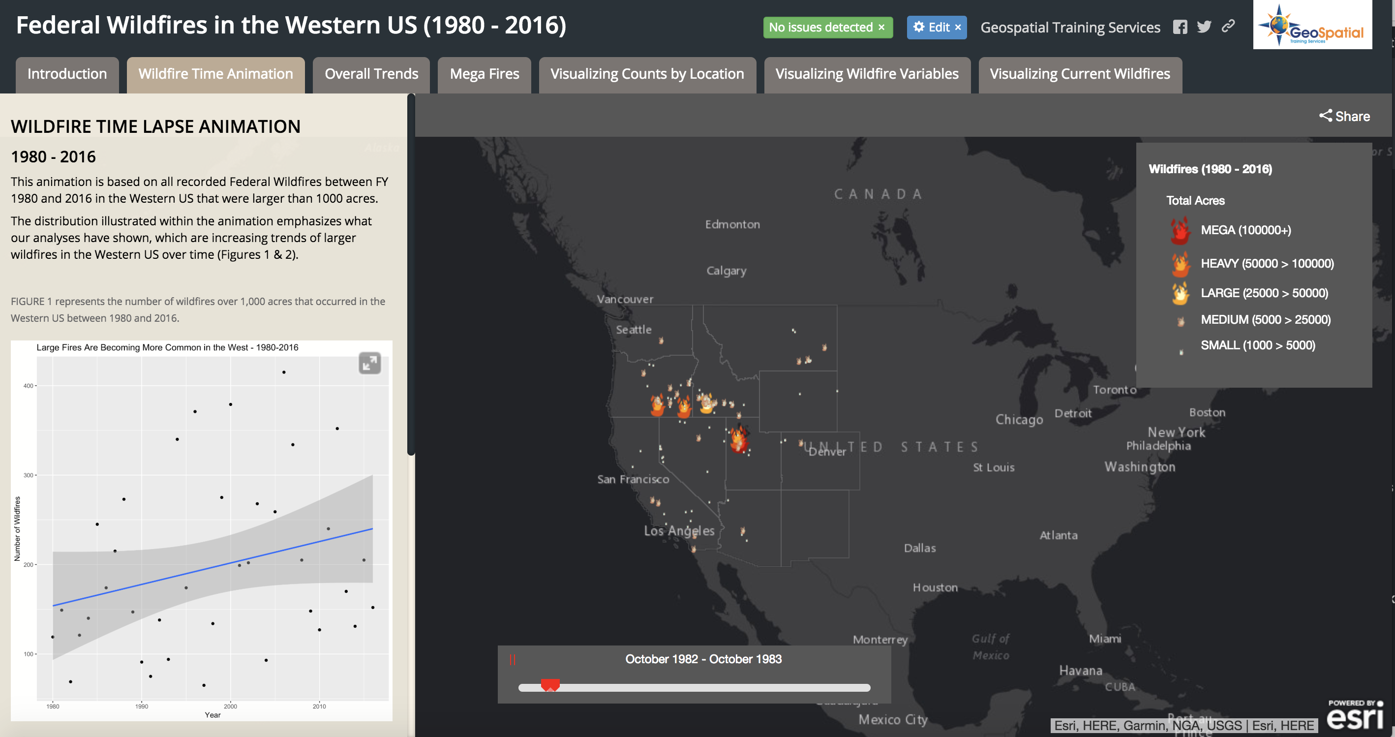
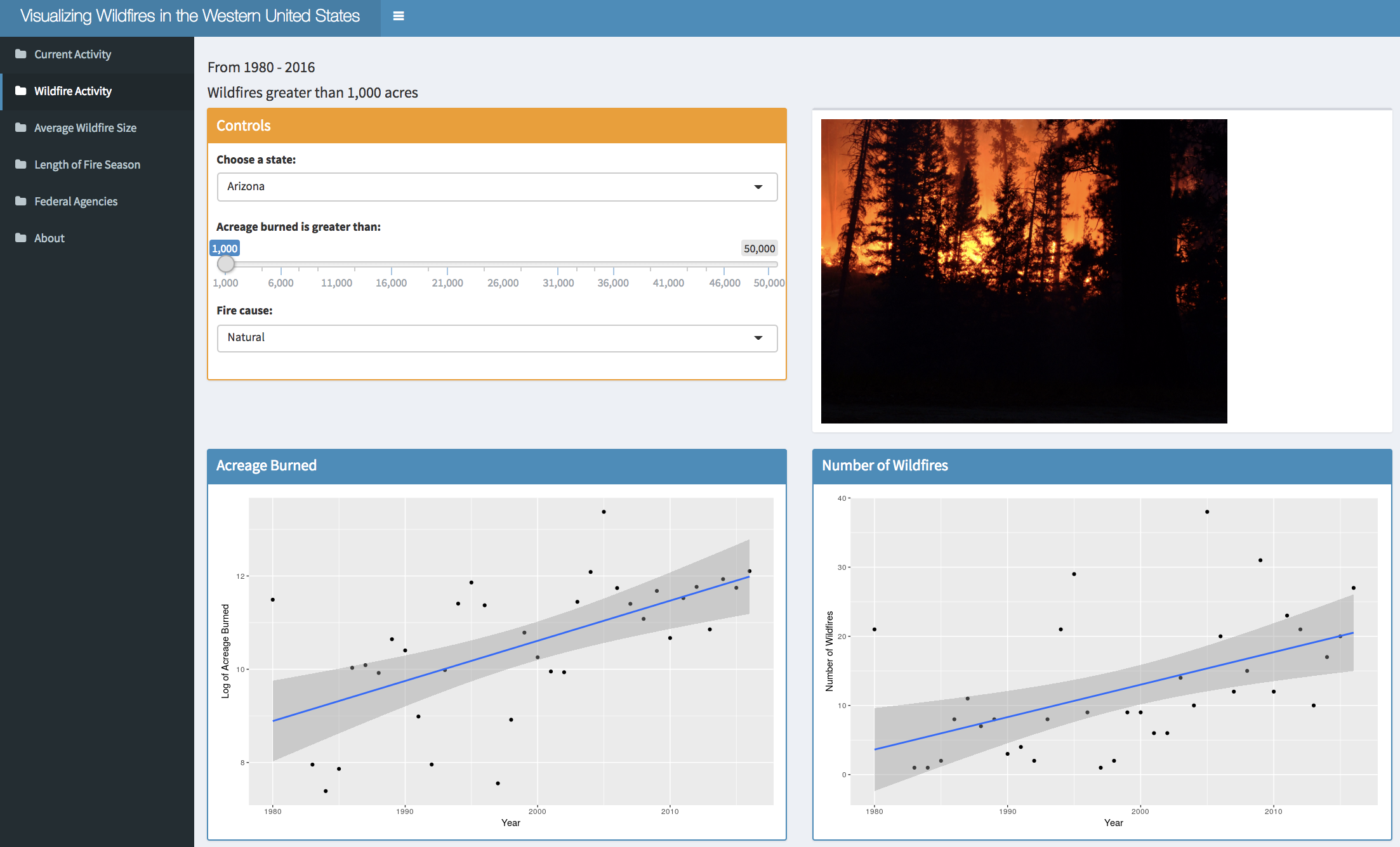
Visualizing Historical Wildfire Information in a Story Map
The 2017 wildfire season shattered records and cost the U.S. Forest Service an unprecedented $2 billion. From the Oregon wildfires to late season fires in Montana, and the highly unusual timing of the California fires in December, it was a busy year in the Western...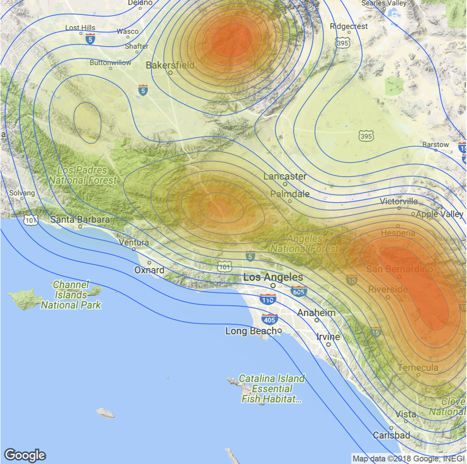
Spatial Visualization with R and ggmap
The ggmap package enables the visualization of spatial data and spatial statistics in a map format using the layered approach of ggplot2. This package also includes basemaps that give your visualizations context including Google Maps, Open Street Map, Stamen Maps, and...