

The New Calculate Field Toolbar in ArcGIS Pro 3.6: A Welcome Quality-of-Life Improvement
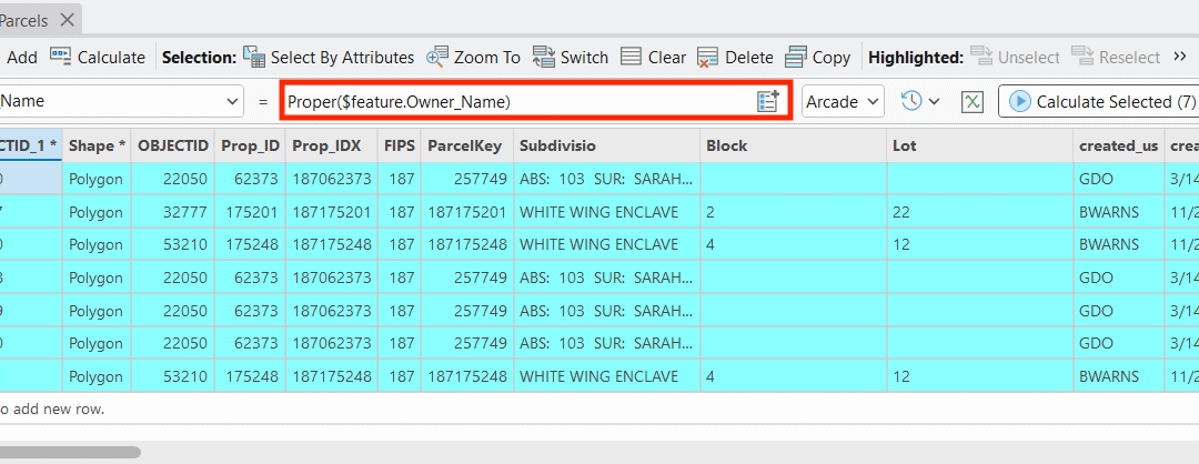
Learn more about ArcGIS Pro in one of our upcoming ArcGIS Pro Bootcamps or our live-online classes. ArcGIS Pro 3.6 introduces a small but mighty addition that will make attribute management noticeably smoother: the Calculate Field toolbar. If you spend any significant...
Introducing Location3x: GIS Services and Solutions
Introduction to Location3x We’re excited to announce the launch of Location3x—a new division of Geospatial Training Services dedicated to helping government agencies get more from their GIS investments. For nearly two decades, we’ve trained over 14,000 GIS...
The GeoAI Reckoning: Disruption, Opportunity, and What GIS Professionals Should Do Now
Navigating opportunity and disruption as AI reshapes the geospatial industry The geospatial industry is experiencing its most significant transformation since the shift from paper maps to digital GIS. Artificial intelligence and machine learning are fundamentally...