Tutorial: Finding Identical Features in a Dataset with ArcGIS Pro
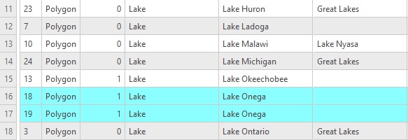
In this tutorial, we’ll explain how you can find identical features (also known as duplicate data) in a feature dataset. Step 1: Download the data We will use the Natural Earth quick start kit. In the tutorial covering bar charts using the matplotlib Python...
URISA – GIS-Pro 2022 in Boise, ID
Geospatial Training Services will be teaching Getting Started with ArcGIS Arcade, Introduction to Experience Builder, and Automating Map Production with Map Series and Python in ArcGIS Pro at the URISA 2022 GIS Pro Conference in Boise.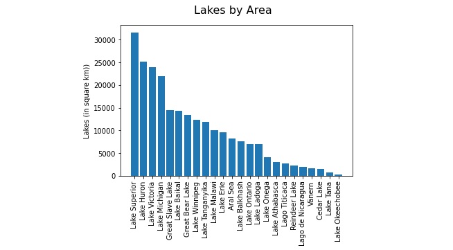
Creating Bar Charts with Python Notebooks
In this tutorial, you’ll learn how to create a simple bar chart in an ArcGIS Pro python notebook. Pro includes a series of pre-installed Python packages. One of these packages is matplotlib, a plotting library which enables you to create bar charts, scatterplots and...