
Articles & Tutorials
ArcGIS Earth 1.1: What’s New and What’s Next
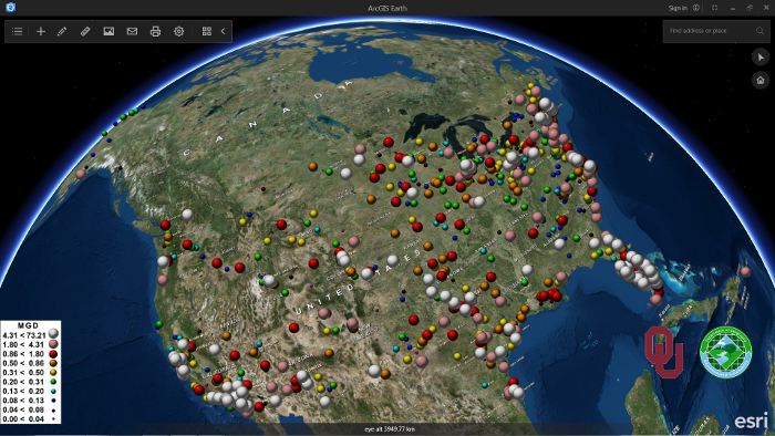
Last April, Esri announced the second release of ArcGIS Earth, version 1.1. This blog post discusses a number of new features that come with this new release, as well as Esri´s roadmap for upcoming releases and features. Last January, Esri released a new software...

ArcGIS Pro 1.3 Released
Esri continues to work and improve on its newest desktop GIS application, ArcGIS Pro. For those that may not be aware of ArcGIS Pro, it is a completely new 64-bit desktop GIS application that makes use of a modern ribbon based interface. Being 64 bit, it can take full...
Introducing the R-ArcGIS Bridge
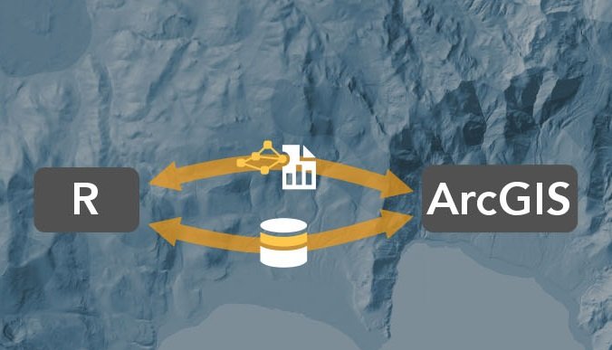
Bringing together the user communities of R and ArcGIS was the motivation behind the release of the R-ArcGIS bridge software package last year. This blog post discusses how GIS can incorporate the R language and enhance geospatial workflows. By Eric van Rees What is...
Widgets and the ArcGIS API for JavaScript 4.0
This blog post discusses how the new ArcGIS API for JavaScript 4.0 deals with widgets. What is a widget? Working with widgets is an essential part of the ArcGIS API for JavaScript. Esri calls widgets “the building blocks of the user interface”. But what is a widget...
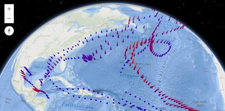
3D Support in the ArcGIS API for JavaScript 4.0
The new ArcGIS API for JavaScript 4.0 introduces 3D capabilities into the world of ArcGIS JavaScript development. This blog post describes the creation of 3D apps, maps views, objects, symbology and streams with the API. Incorporating Web Scenes The new ArcGIS API for...
ArcGIS API for JavaScript 4.0 Released
The new ArcGIS API for JavaScript 4.0 is a “next-generation” release that not only introduces new functionality but is also a fundamental change from 3.x versions. This blog post highlights some of the new functionality and changes that come with the new API. Why a...
Webinar Recording – A Brief Introduction to QGIS
Learn the basics of QGIS in this recorded webinar from March 29th, 2016. You can also download the slides. Our Introduction to QGIS course is also available if you want to learn the full capabilities of QGIS. https://vimeo.com/160836794
Webinar Recording – Introduction to ArcGIS Earth
Learn the basics of using ArcGIS Earth in this webinar. You can also download the lecture slides for Introduction to ArcGIS Earth. For more information on ArcGIS Earth please consider our 1/2 day Introduction to ArcGIS Earth classes coming soon....
ArcGIS 10.4 Released and ArcGIS Pro 1.2 Coming Soon
This is a guest post by Tripp Corbin, CEO of eGIS Associates and an instructor with Geospatial Training Services. Esri has just released ArcGIS 10.4. This includes updates for ArcGIS for Desktop, ArcGIS for Server, ArcGIS Online and Portal for ArcGIS. Next month, Esri...