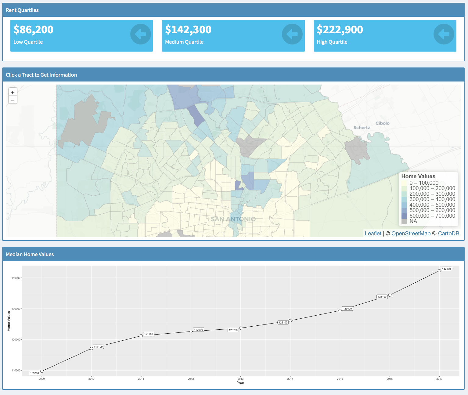
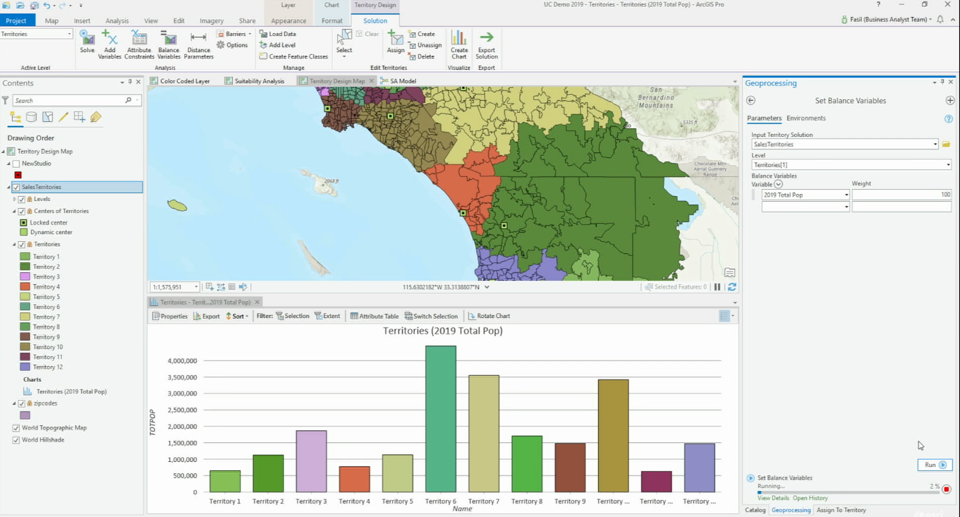
Articles & Tutorials

Spatial Visualization with R and ggmap

Spatial Visualization with R and ggmap

The ggmap package enables the visualization of spatial data and spatial statistics in a map format using the layered approach of ggplot2. This package also includes basemaps that give your visualizations context including Google Maps, Open Street Map, Stamen Maps, and...

read more
Interactive Wildfire Application for Western United States

Interactive Wildfire Application for Western United States

Using the Federal Wildland Fire Occurrence Database along with current wildfire activity information provided by Inciweb and drought information provided by the University of Nebraska, Geospatial Training Services has developed an interactive web application for...

read more
ArcGIS Pro Class Descriptions – 7 Classes Now Available

ArcGIS Pro Class Descriptions – 7 Classes Now Available

The demand for ArcGIS Pro training has been growing at an ever increasing rate. To meet this demand, we have developed seven classes ranging from beginner to advanced levels of ArcGIS Pro.  Below you will find class descriptions for all seven of our ArcGIS Pro...

read more

Configuring ArcGIS Pro Options

Today’s video provided courtesy of Tripp Corbin of eGIS Associates. Upcoming ArcGIS Pro Classes.  You can save up to 15% on any of these courses during the month of May, 2018. Learning ArcGIS Pro 2: Analysis, Automation, and...

read more
How to Add GIS to your Data Science Skills

How to Add GIS to your Data Science Skills

During our 14th Annual Anniversary Sale you can save up to 25% on GIS training. As we´ve seen in the first article, the future for data scientists looks bright. Here, we´ll cover how GIS technology can enhance the skillset of any data scientist. As discussed in the...

read more
Become a Better Data Scientist with these GIS Skills

Become a Better Data Scientist with these GIS Skills

During our 14th Annual Anniversary Sale you can save up to 25% on GIS training. In the last article we discussed how data science skills can be linked to GIS technology. In this article, we’ll have a look at how GIS skills can improve your work as a data scientist. In...

read more
600+ Federal, State, Local Open GIS Data Servers

600+ Federal, State, Local Open GIS Data Servers

Earlier this year, Joseph Elfelt of MappingSupport.com posted two pdf files with internet addresses for federal and state ArcGIS servers with open data.  That work has now been combined into a single pdf file.  In addition, internet addresses for various regional,...

read more

Categories

Recent Posts

Sign up for our weekly newsletter
to receive content like this in your email box.