
Save 25% on GIS Training – 14th Annual Holiday Sale
Our 14th annual holiday sale begins this Monday, November 20th. You can save up to 25% on any GIS training that we provide including our Annual GIS Training License and any of our live training events below. Simply use the discount code ‘holiday’ when...
Getting to know GeoPandas
This blog post covers GeoPandas, a Python package that makes working with geospatial data easier. What is GeoPandas? GeoPandas is an open source project for working with geospatial data in Python. It is designed to work with existing tools, such as desktop GIS,...
New Webinar – Creating a Map Series (Map Book) in ArcGIS Pro
On Friday, February 9th we’ll be releasing a new recorded webinar entitled Creating a Map Series in ArcGIS Pro. A map series is a collection of map pages (also known as map sheets) built from a single layout that represents a geographic area. The most common type is...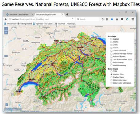
Open Source GIS Bootcamp Begins in January
Have you ever wanted learn how to use open source GIS software offerings to develop web based GIS applications? Here is your opportunity! GeoSpatial Training Services is now offering a hybrid instructor guided, web based course covering open source GIS software...