
Free Chapter – Building Web and Mobile ArcGIS Server Apps with JavaScript
We’re happy to announce that our latest book, Building Web and Mobile ArcGIS Server Applications with JavaScript, has been published by Packt Publishing. The book was co-authored by Eric Pimpler and Mark Lewin and is available for sale in both digital and hard copy...
New Book – Building Web and Mobile ArcGIS Server Applications with JavaScript
We’re happy to announce that our latest book, Building Web and Mobile ArcGIS Server Applications with JavaScript, has been published by Packt Publishing. The book was co-authored by Eric Pimpler and Mark Lewin and is available for sale in both digital and hard...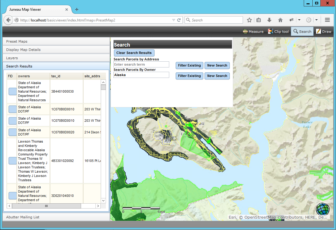
City of Juneau Parcel Viewer
The City and Borough of Juneau, Alaska contracted with Geospatial Training Services to build a public Parcel Viewer application. Parcel Viewer is a free online application that shows an aerial view of Juneau with each piece of property — the parcels — outlined in...
New Features in the ArcGIS JavaScript API 4.2
This blog post covers new features in the ArcGIS JavaScript API 4.2, released as part of ArcGIS 10.5. Discussed below are new widgets, smart mapping in 2D and 3D, vector tiles in 3D, support for the Arcade scripting language and more. Widgets Widgets are reusable...