
Getting to Know GeoJSON
GeoJSON is a geospatial data format that has become quite popular in the last few years. This blog post discusses what GeoJSON is, how you can create it and some Esri tools that enable using the format. What is GeoJSON? The GeoJSON data format is a data format based...
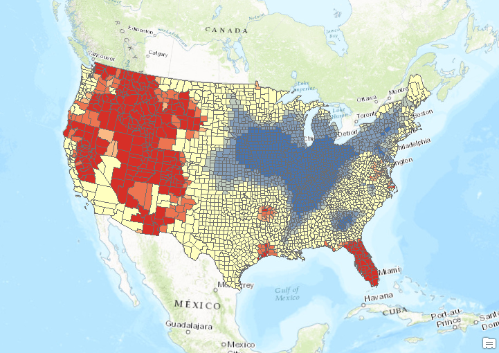
Analyzing Wildfire Activity with Spatial Analytics – Part 2
Part 1 – Analyzing Wildfire Activity with Spatial Analytics In this post we’ll continue our analysis of wildfire activity using spatial analytics techniques. In part 1, we downloaded historical wildfire information for the years 2002-2016 from a USGS...
ArcGIS Pro Tip – Geoprocessing Pane: To Auto-Hide or Not?
ArcGIS Pro is Esri’s latest Desktop GIS Application. It will be replacing ArcMap and ArcCatalog at some point (We have heard anywhere between 2 to 7 years). ArcGIS Pro is still very much a work in progress but it has come a long way since first released in 2015....