

For upcoming Experience Builder courses, view our training schedule: GIS Training – Geospatial Training Services
The Add Data widget in ArcGIS Experience Builder offers a simple way to allow users to dynamically bring additional data into a web application. Rather than working only with preconfigured layers, this widget gives end users flexibility to add their own content on demand, expanding the usefulness of public-facing or internal apps. This article provides an overview of the benefits and limitations of the Add Data widget.
What the Add Data Widget Does
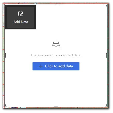
The Add Data widget allows users to insert additional data into an Experience Builder app during runtime. This can include adding files from their local machine or connecting to online data sources. Once added, these datasets can be used within the app for visualization and limited interaction, depending on how the app is configured.
The widget supports multiple data types, including:
-
ArcGIS Web Services
-
ArcGIS Online web maps and web scenes
-
Feature layers (hosted or ArcGIS Server)
-
Map image layers
-
Scene layers
-
-
Local Files (Uploaded by the User)
-
CSV
-
Shapefile (packaged as ZIP)
-
GeoJSON
-
GPX
-
KML
-
-
Other Data Sources
-
OGC services (WMS, WMTS, WFS depending on configuration)
-
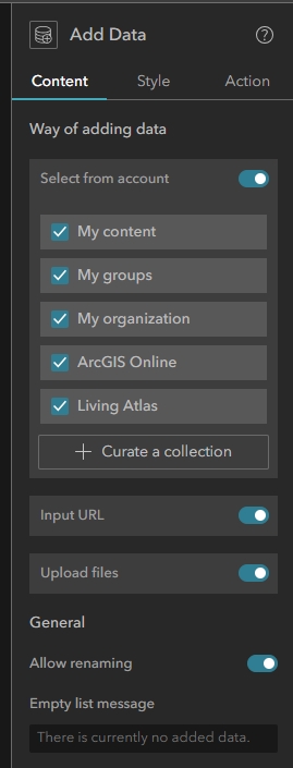
Widget Configuration Options
When configuring the Add Data widget, app creators can control which types of data users are allowed to add. This includes enabling or disabling:
-
Web maps and web layers from ArcGIS Online
-
ArcGIS Server and OGC services
-
Uploading of specific file types (CSV, GeoJSON, GPX, KML, Shapefile)
In addition, creators can allow or prevent users from renaming layers after they have been added to the app.
These configuration options help limit the types of content allowed and ensure appropriate data formats are supported for the intended audience.
Benefits of Using the Add Data Widget
-
Dynamic Data Exploration
Users can bring in datasets that are not part of the original application design, which supports exploration of ad-hoc data sources or temporary files. -
Public User Enablement
In public-facing applications, the Add Data widget allows general users to overlay their own files without needing access to the original AGO organization or data management privileges. -
Lightweight Data Sharing
The widget allows users to quickly combine operational layers from multiple sources without permanently storing or publishing them into ArcGIS Online. -
Support for Multiple Formats
By allowing both web services and file-based formats, users have flexibility to bring in data from a wide range of sources.
Limitations of the Add Data Widget
-
Temporary Session-Based Data
Data added through the widget exists only during the current browser session. Once the app is closed or refreshed, added data is lost unless the app developer provides custom storage solutions. -
No Write-Back to AGO
The widget does not support saving or publishing added data back into ArcGIS Online or Enterprise. This is purely for temporary visualization. -
Limited Interactivity
Added data can typically be visualized alongside existing layers. Users can adjust basic display properties such as transparency (if supported by the Layer List widget), but cannot modify symbology or perform advanced styling directly within the application unless pre-configured by the app developer.
The Add Data widget can trigger map-based actions such as pan and zoom when new data is added. In addition, once data is added, other widgets (such as Table or Query) may expose Data Actions like Export or Show on Map for the added layers. -
File Size Limits
Uploading local files is subject to size limitations that may vary based on browser constraints or system defaults. -
No Attribute Editing
The Add Data widget does not allow editing or updating of attributes or geometry on added layers.
Summary
The Add Data widget is a valuable tool when applications need to support temporary, user-driven data exploration across multiple formats and sources. It offers flexibility for both internal and public users to enrich applications with additional content during runtime, while maintaining a clear boundary that prevents permanent changes to the system or underlying data sources. Understanding its session-based nature and interaction limitations helps ensure it is used in the right context.
To learn more about our Introductory and Intermediate Experience Builder courses, view our course catalog: GIS Training Courses – Full Catalog – Geospatial Training Services
