Understanding the Geodatabase Format in ArcGIS Pro – Part 1
Part 1 of a 6 part series on the geodatabase data format. Foundation and Core Concepts The geodatabase is the cornerstone of data management in ArcGIS Pro, representing Esri’s flagship format for storing, managing, and analyzing geographic information. Unlike...
ArcGIS Pro 3.5: Enhanced Performance and Intelligence for Modern GIS Workflows
Learn more about ArcGIS Pro in our introductory Mastering ArcGIS Pro 3: Maps, Layers, Projects, and Layouts class and our intermediate level Mastering ArcGIS Pro: Editing, Analysis, and Automation class. The May 2025 release of ArcGIS Pro 3.5 delivers significant...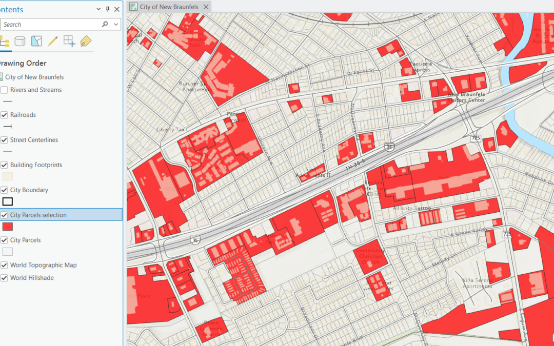
Mastering Selection Layers in ArcGIS Pro: A Powerful Tool for GIS Analysis
Our annual Spring Sale is underway! Save 20% on any of our classes through May 31st by using the discount code springsale when checking out online. Selection layers are one of the most versatile yet sometimes overlooked features in ArcGIS Pro. Whether you’re a...